Tsagarada-Milies
Long Pelion Trail
Tsagarada-Milies
Long Pelion Trail
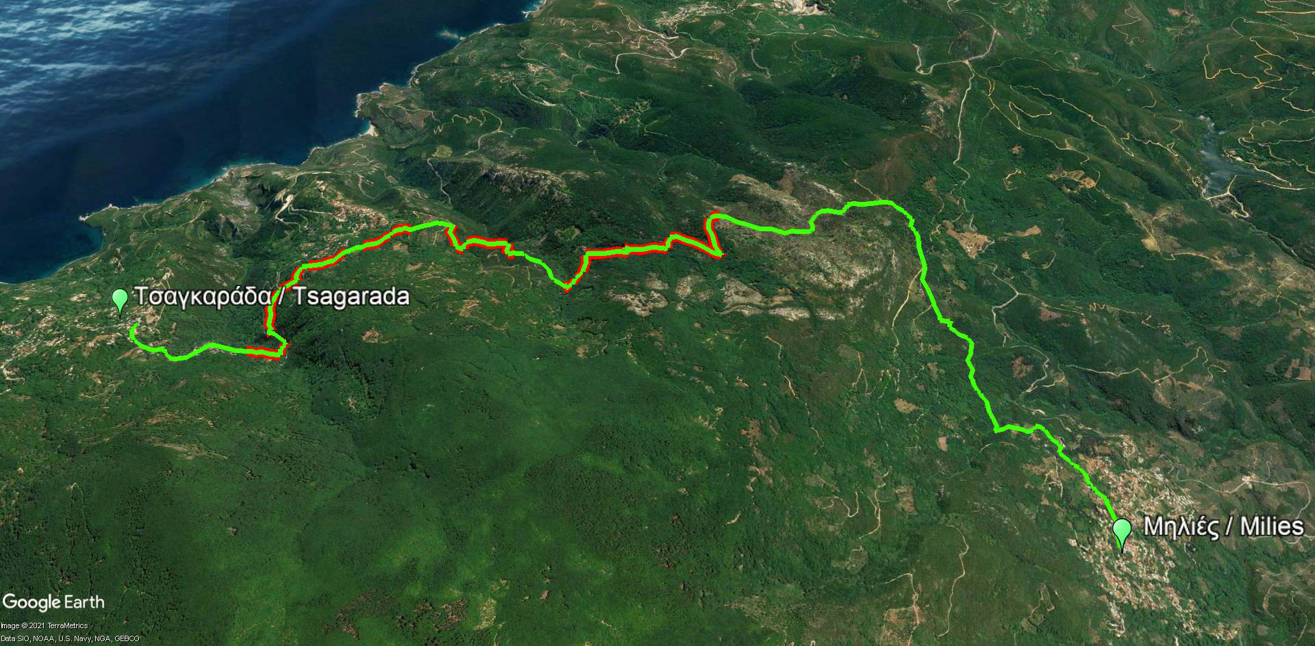
Tsagarada-Milies route
Πατήστε για μεγέθυνση
Tsagarada-Milies route
Πατήστε για μεγέθυνση
×

Long Pelion Trail
Tsagarada-Milies route
Tsagarada-Milies route
| Section name |
Difficulty |
Length m |
Ascent m |
Decent m |
Maximum elevation m |
Minimum elevation m |
Time h |
|---|---|---|---|---|---|---|---|
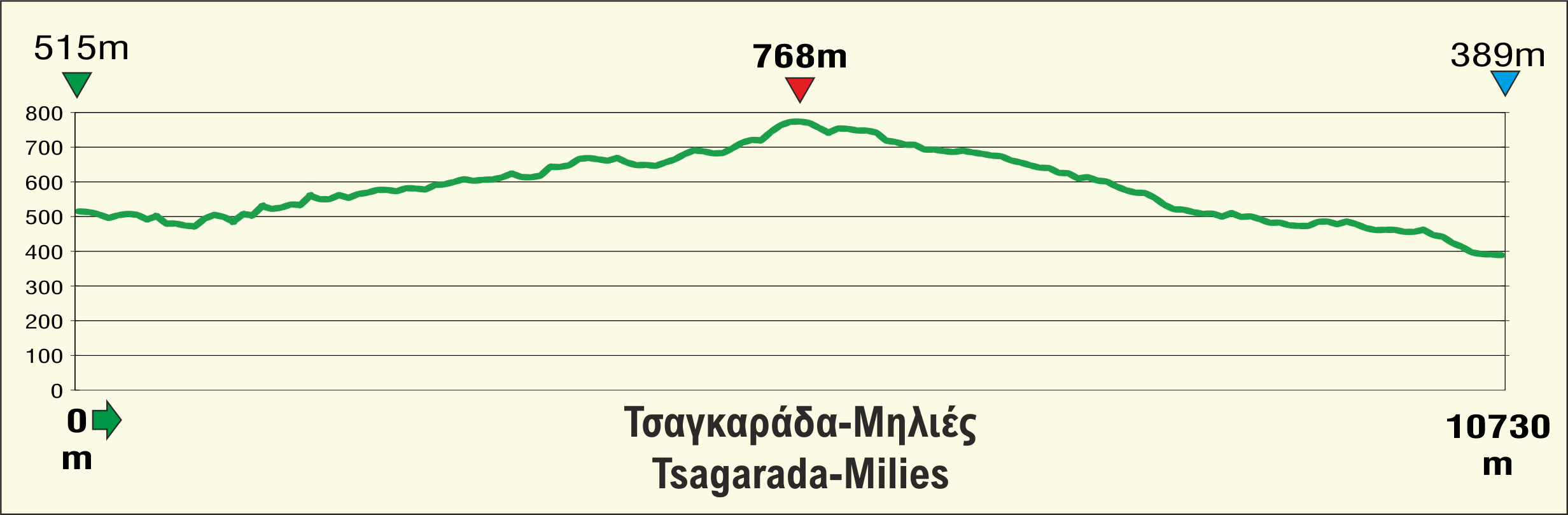
| Tsagarada-Milies | 2/5 | 10726 | 364 | 490 | 768 | 389 | 4 |
Long Pelion Trail
Elevation profile of Tsagarada-Milies route
Elevation profile of Tsagarada-Milies route
Long Pelion Trail
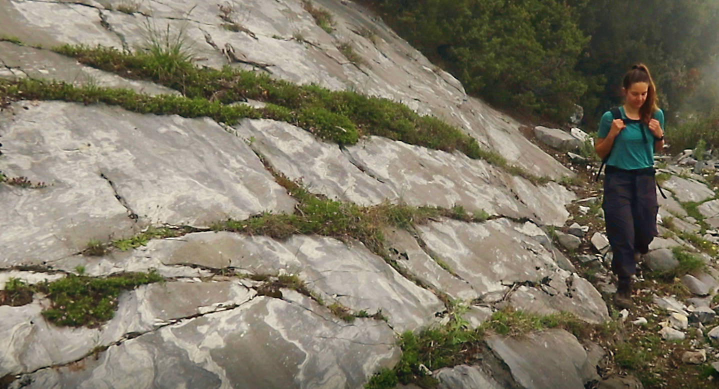
On the Tsagarada-Milies route
Πατήστε για μεγέθυνση
On the Tsagarada-Milies route
Πατήστε για μεγέθυνση
×

Long Pelion Trail
On the Tsagarada-Milies route
On the Tsagarada-Milies route
The sixth part of LPT connects Tsagarada, which is the larger center of eastern Pelion, with Milies, the heartland of agricultural activities and depot of the old railway Lechonia-Milies.
Long Pelion Trail
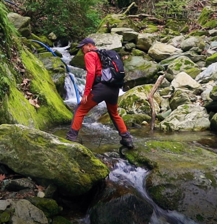
Crossing the Mylopotamos riverbed
Crossing the Mylopotamos riverbed
Text: Aik. Zagaretou, photos: T. Adamakopoulos
Walkability chart-Warnings
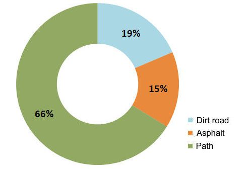
2/3 of the route runs on paths, for the most part old cobbled paths that have been splited. Part of the dirt roads along the way are essentially widenings of the old cobbled pathways. The route is marked with sparse red markings.
The length of the route is 10.7 km and can be done in 4 hours.
The length of the route is 10.7 km and can be done in 4 hours.
Long Pelion Trail topoguide
The best escort on Long Pelion Trail is the guide Long Pelion Trail topoguide, a member of the Long Trails group of the app topoguide Greece, available for Android devices via the Google Play Store.
The guide Long Pelion Trail topoguide is also available for iOS (iPhone και iPad) devices via the app Topoguide Greece, as a member of the Long Trails group.
The application offers active navigation along the trails, as well as a concise guide on the geography, the nature and the culture of Mt Pelion.