Valtoudi-Tisseo-Trikeri-Agia Kyriaki
Long Pelion Trail
Valtoudi
Mt Tisseo
Trikeri-Agia Kyriaki
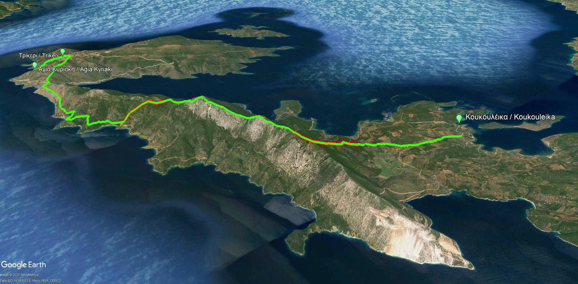
Click to enlarge
Valtoudi-Tisseo-Trikeri-Agia Kyriaki route
| Section name |
Difficulty |
Length m |
Ascent m |
Decent m |
Maximum elevation m |
Minimum elevation m |
Time h |
|---|---|---|---|---|---|---|---|
| Valtoudi-Tisseo-Trikeri-Agia Kyriaki | 4/5 | 19705 | 1065 | 1072 | 650 | 0 | 8 |
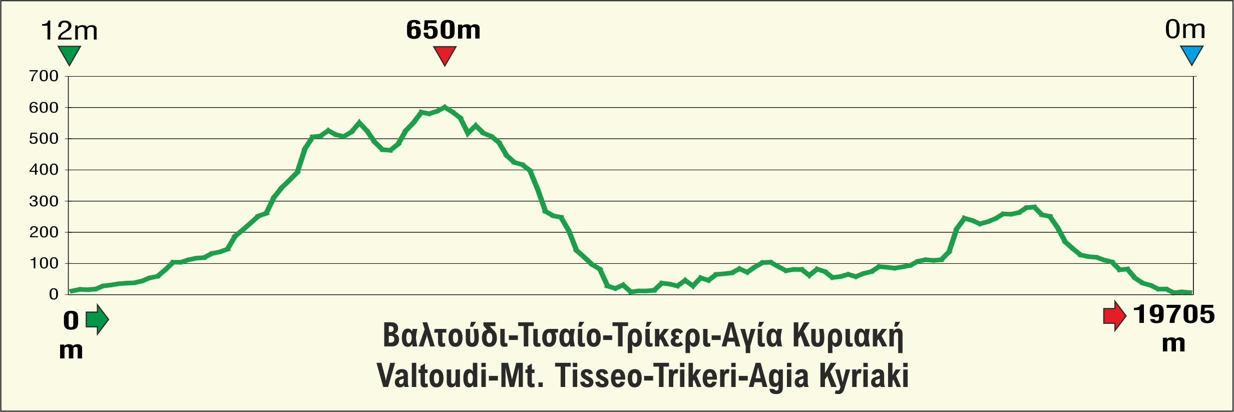
Valtoudi-Tisseo-Trikeri-Agia Kyriaki route elevation profile
The peninsula of Magnisia ends like a fish hook at Cape Trikeri. This rough tip is the most majestic mountain landscape in the entire region of Mt Pelion. The barebone of the cape is a craggy, rocky ridge covered with thorny fragrant bushes and it is called Mt Tisseon. So, Long Pelion Trail keeps its best part for the very last day, offering a demanding route, yet a joy for experienced hiker.
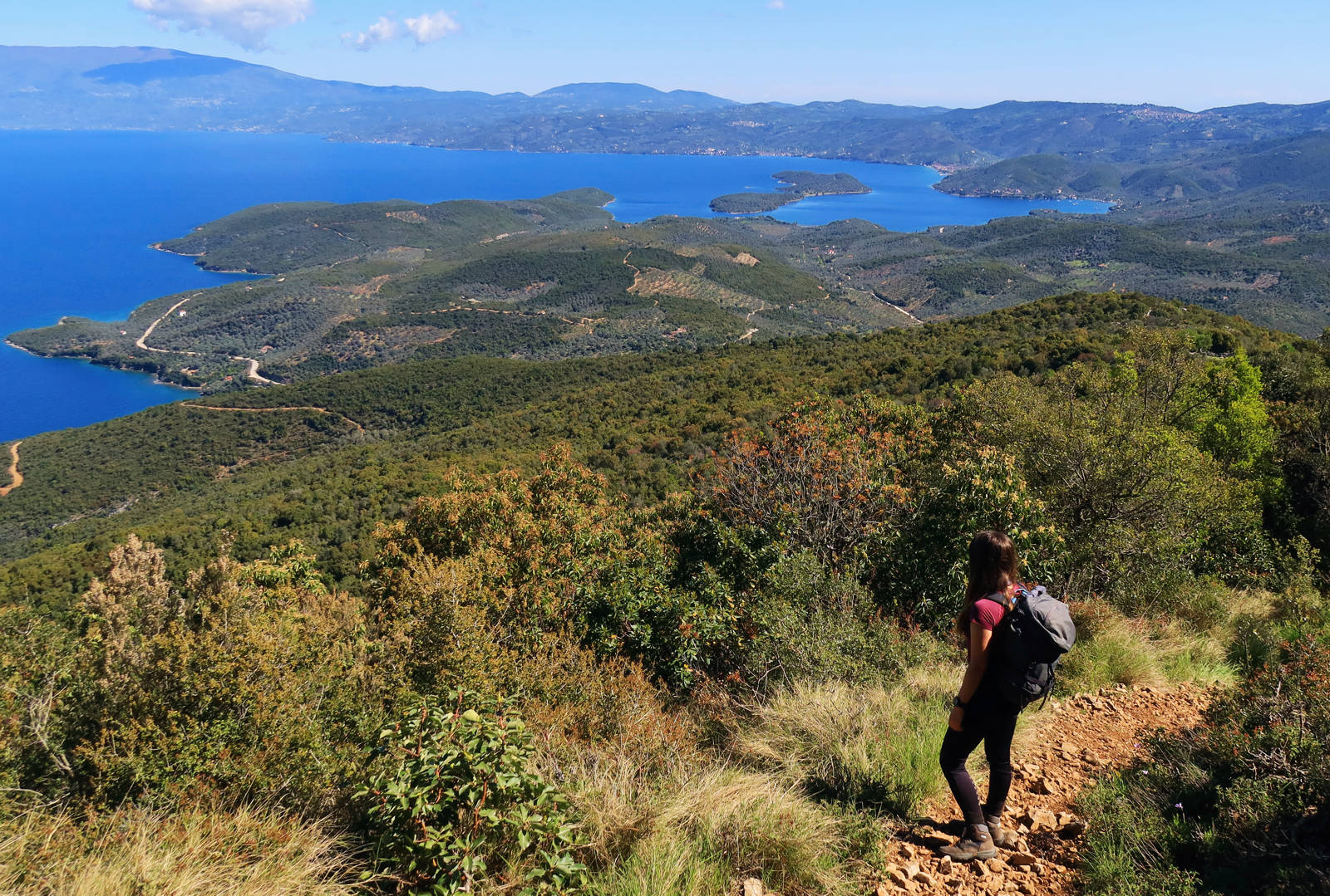
Click to enlarge
Going for Mt Tisseon
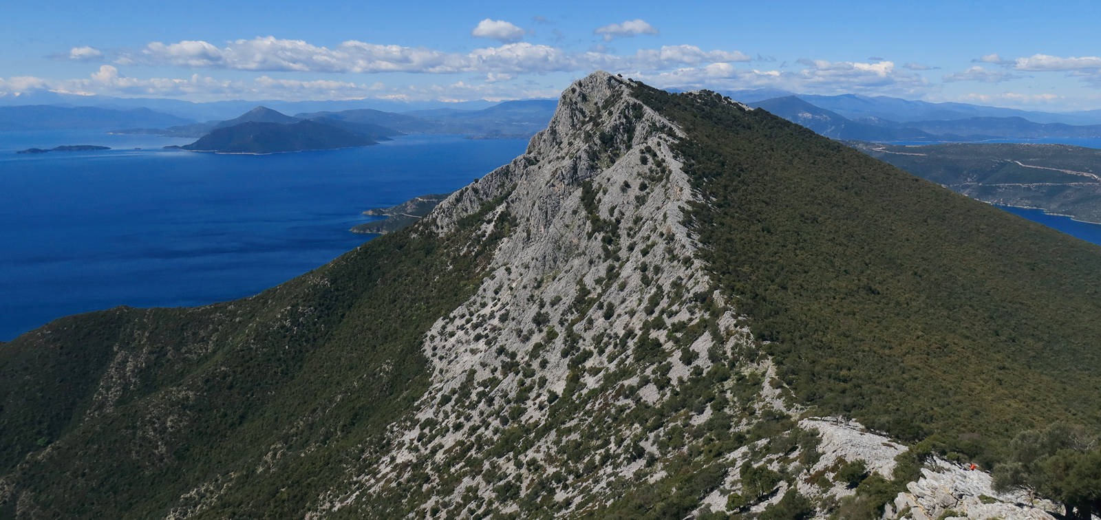
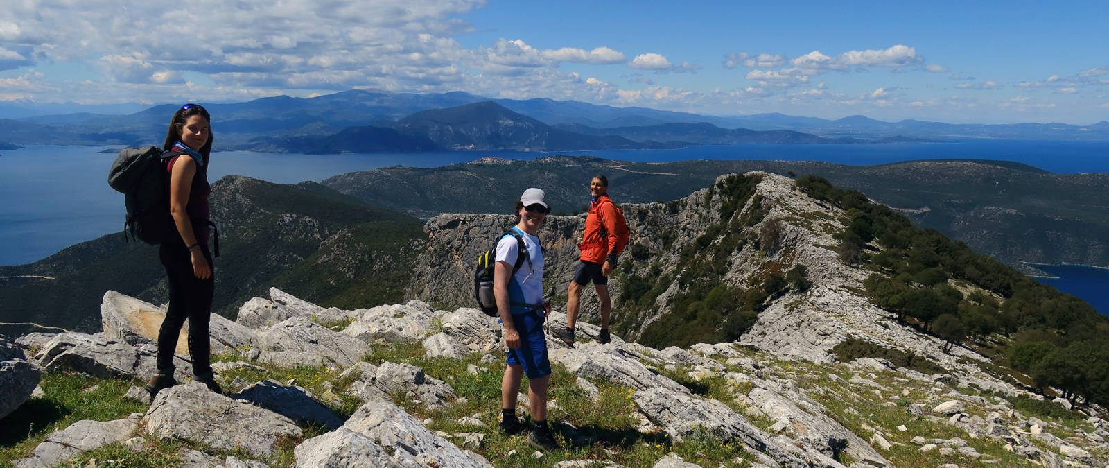
Climb Mt Tisseon slopes following a well defined trail and walk along the ridge on a challenging rocky terrain. Despite the difficulties of walking on the large and irregular blocks, on could enjoy a strikingly beautiful view to the wild beaches of Mt Pelion, to Pagasitikos Gulf and even to the Aegean Sea.
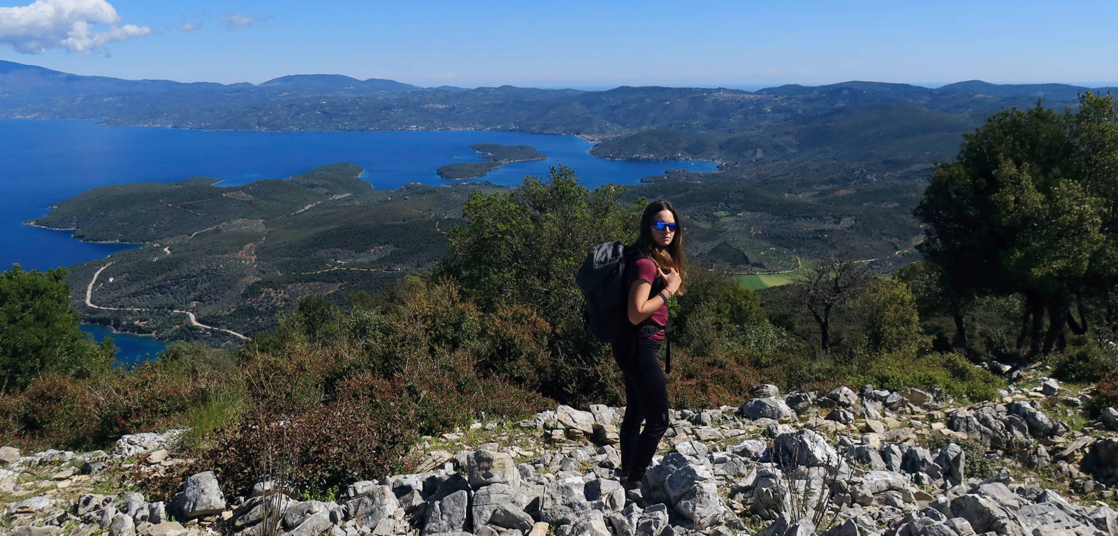
Click to enlarge
Approaching the ridge of Mt Tisseon
Click to enlarge
Evzonas, the highest summit of Mt Tisseon
Click to enlarge
Walking down from Mt Tisseon summit to Trikeri
Text: Aik. Zagaretou, photos: T. Adamakopoulos
Walkability chart-Warnings
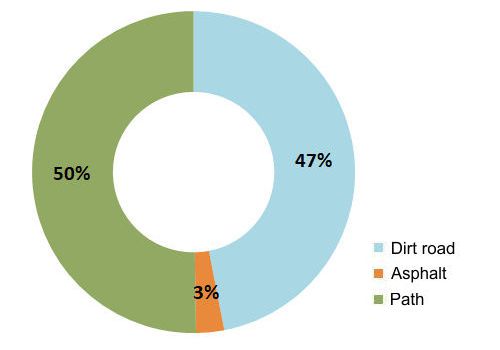
The whole route is exposed to the sun.
The length of the route is 19.7 km and can be done in 8 hours.
Long Pelion Trail topoguide
The best escort on Long Pelion Trail is the guide Long Pelion Trail topoguide, a member of the Long Trails group of the app topoguide Greece, available for Android devices via the Google Play Store.
The guide Long Pelion Trail topoguide is also available for iOS (iPhone και iPad) devices via the app Topoguide Greece, as a member of the Long Trails group.
The application offers active navigation along the trails, as well as a concise guide on the geography, the nature and the culture of Mt Pelion.

