Discover Mani: Gythio
Discover Mani: Gythio

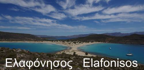
Click to enlarge
Eastern Mani covers the entire sunward side of the Mani peninsula, from Gythio to Tenaro peninsula. This elongated area is limited geographically between the ridge of Mt Sangias and the sea. The shoreline is a sequence of rocky slopes ending in steep, practically inaccessible, coasts.
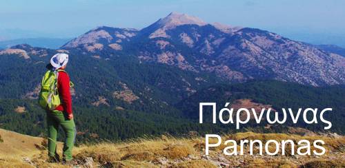
In general, the landscape of the eastern side is a mirror image of the landscape of western Mani: in the north, the foothills of Mt Taygetos, as well as the rugged Mt Zygos in the west and the arid Mt Lykovounia in the east, look like a typical mountainous region, made of forests, valleys, ravines and small or intermittent rivers. And just as Western Mani is enriched with the Avia region, so Eastern Mani joins Bardounia and Malevri, rich and multifaceted regions, compared to the minimalistic landscape of southern Mani.

Click to enlarge
South and west of Gythio, the relief becomes sharply curvy and difficult to decipher, however the terrain remains friendly, making the castle of Pasavas look like an anachronistic extravagance.
A little further south, starting from Ageranos and as soon as we reach the basin of Kotron, the outskirts of Mt Sagias notify the traveller for the beginning of the Deep Mani region.
Although the crossing between East and West mani pass over an elevation of just 160 m and is served by many parallel and easily traversed passages, it exudes an elusive threat. It is not the terrain or the elevation that haunts the passage to Mesa Mani: it is the awe that inspired the name of this race of indomitable warriors, the fame of centuries of resistance, and the memory of the vain attempt to tame them.

The real Mani, arid, barren and geographically isolated - and at the same time, poor and wild - starts from the line connecting the villages Pyrichos, Karyoupolis and Vachos. The Mesa Mani region breathes along Mt Sangias, in its somewhat smoother ending towards the Messinian Gulf and in the narrow arable landstrip towards Laconicos Gulf.
The eastern side is even poorer and wilder than the western, if it is possible to make a distinction between two regions without arable land, water resources, a real hinterland, viable mountain resources and communication ways.
As in the western part of Mt Sangias, no truly mountainous settlement was ever established on the east side of the rocky mountain range. The sole districts on the highlands are the large but seasonal settlements of the breeders and some peculiar occasions, such as the Kournos monastery - here the attraction was of course the water - and the Prophet Elias - thanks to the quarries of the wonderful antico rosso.
Finally, alike the west side, it is difficult today to distinguish any local urban center. Even where tourism has timidly made its appearance, a minimal commercial nucleus is barely formed. Skoutari, Kotronas, Flomochori, Laia and Kokkala, each one of the quite large villages host a few shops - a bakery, possibly a mini-market and some basic equipment store for construction and agricultural activities.
topoguide Greece
Traveling along Mani peninsula
A detailed description of Gythio district, villages, nature and civilization is offered in Gythio topoguide.
Gythio topoguide is available for Android devices as one of dozens of regions of Greece offered by the application topoguide Greece. Get the Gythio topoguide as an in-app purchase.
Gythio topoguide is also available for iOS (iPhone και iPad) devices as one of the regions offered in the hiking application Topoguide Greece. Get the in-app purchase Gythio topoguide and explore Mani peninsula.