Alonnisos Great Traverse
Long Trails
Alonnisos Great Traverse
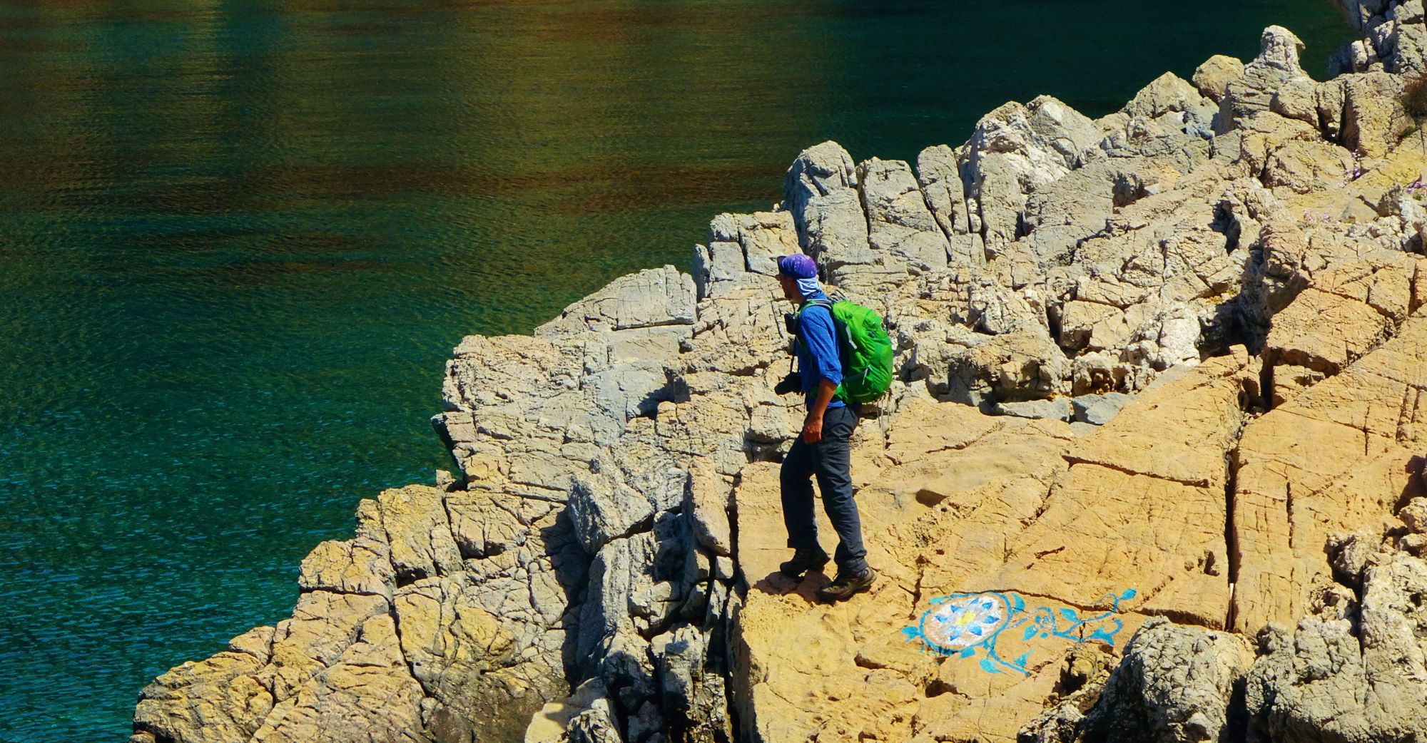
Alonnisos Great Traverse
Tourkoneri beach
Πατήστε για μεγέθυνση
Alonnisos Great Traverse
Tourkoneri beach
Alonnisos Great Traverse is made of a combination of paths and roads, most of which made already part of other hikes. The interest in the creation of this long route is on the one hand that it crosses the entire island and on the other hand it connects with all the hiking routes of Alonissos.
Alonnisos Great Traverse starts from Chora, passes over Patitiri and Votsis and reaches Mega Nero spring.
From Mega Nero it follows the nice trail to Agii Anargyri and continues via Tourkoneri to Megali Ammos and Agalou Lakka.
From Agalou Lakka it goes up to the Megalo Chorafi and reaches Psili Rachi and then Agios Konstantinos chapel. It continues on the good path to Melegakia, where it meets the asphalt.
The route then follows the asphalt for 2.3 km and leaves it to enter the dirt road to Papi. From the end of the dirt road, continue on the edge of the rocks and finally descend towards the middle of Gerakas beach, the end of the route.
The way back could be made by prior agreement with a vehicle or taxi.
The route is almost 25 km long and can be done in 10 hours.
Text and photos by T. Adamakopoulos
Signage
Marking and signposting
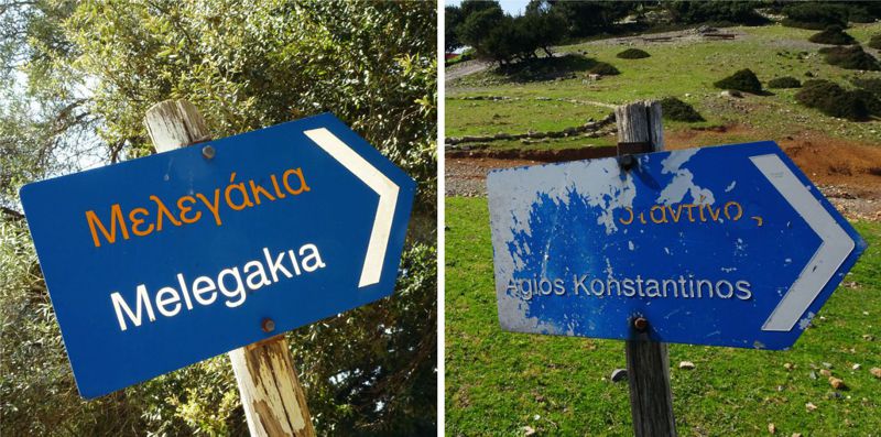
On route, we encounter most of the direction signposts of the older hiking network of Alonissos, which, although worn, serve quite well the orientation of the hiker.
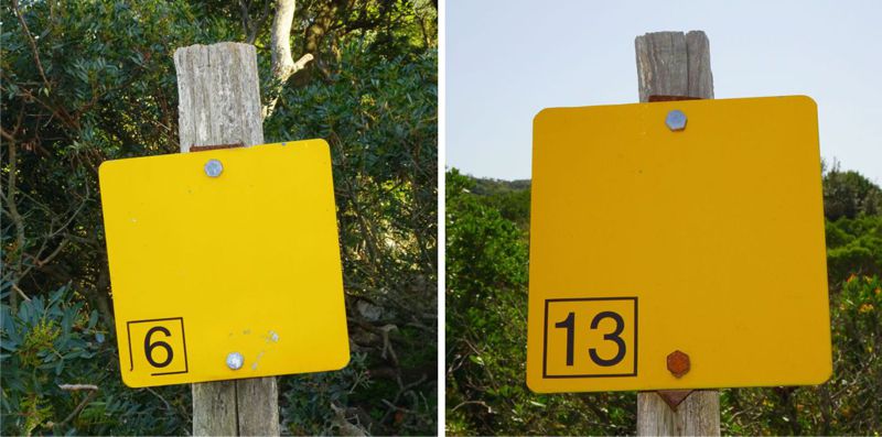
Along the more mountainous part of the trail, we will find several yellow numbered signs of the old hiking network (mostly from Routes 6 and 13), as well as many red signs.
Warnings and notifications
Food and water supply
Due to the length and distance from the main villages, it is necessary to consider Alonnisos Great Traverse under the logistic approach of autonomous tekking: start the trail with food and water supply for a 10-12 hour walking time, most of it exposed to the sun and winds the ridge.
Do not trust the water sources along the route (Mega Nero, other springs, wells in Agios Konstantinos, etc.). In the summer curry at least 2 liters of water.
There is mobile phone reception throughout the trail.
Water resources in Alonnisos
The wells of the mountains
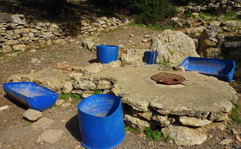
Wells built in strategic locations are opened near huts or plateaus, where farming facilities or livestock activities were already established, nearby main crossroads or chapels, in a location where eventualy an underwater stock could be present - ravines, old gully beds. Other wells are drilled in places where there is a gush, places where rain water enters the broken ovelying soil or places where the ground surface could shaped easily of plastred properly to guide rain water directly to the well.
There are two wells near Agios Konstandinos chapel. They have been opened in shale soil, which, although it has a fragile structure, is watertight. The water comes from the drainage of a small impervious surface of slightly shaped ground. Essentially, they are more likely underground cisterns than proper wells.
Orchids of Alonnisos
Orchis quadripunctata
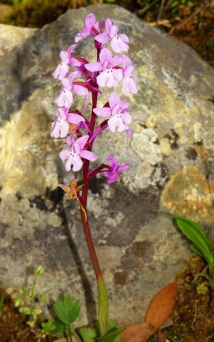
A very common species throughout the low- and mid-elevation zone of Greece, it is easily found in all the Aegean islands and Crete, as well as in Alonissos, in phrygana, stony places and bright bushes, from the end of March until May. In a good location this orchid carpets the ground.

topoguide Greece
ALONNISOS TOPOGUIDE
The digital field guide Alonnisos topoguide is available for Android devices as an in-app purchase within the application topoguide Greece. Alonnisos topoguide is a member of the Greek Islands group.
The digital field guide Alonnisos topoguide is also available for iOS (iPhone and iPad) devices as an in-app purchase within the application Topoguide Greece. There also, Alonnisos topoguide is a member of the Greek Islands group.

