Mt Hymettus trails
Mt Hymettus trails
An outline
More than 200 km of trails have been opened and marked and are walked daily on Mt Hymettus, covering the entire mountain. Hikers from all over Attica, systematically take walks, hikes, runs, mountain bikes, long traverses and crossings, maintaining in a natural and direct way a remarkable path network.

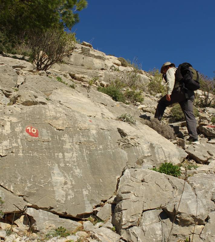
On the original track of Trail 10, from Sesi plateau to Evzonas peak
Several years ago, two major crossings of the mountain were marked, the longitudinal Route 10, which starts from Agia Paraskevi and ends in Terpsithea, and the transverse Route 5 , which starts from the interrchange of Katehaki motorway towards Kessariani monastery, passes by the Kalopoula spring and ends between Glyka Nera and Peania suburbs.
One of the most interesting routes is the ancient Sfittia Way, which crosses Mt Hymettus at its lowest pass, Stavros (= the Pass of the Cross).
The passability of Mt Hymettus trails varies and depends mainly on the degree of use, as little has been done for their maintenance and marking. Local municipalities started planning a network of routes, most of which are marked (such as the routes Korakovouni-Agia Eleousa, Green Trail, Papagou-Peania and Papagou-Pyrgos Anthousas).
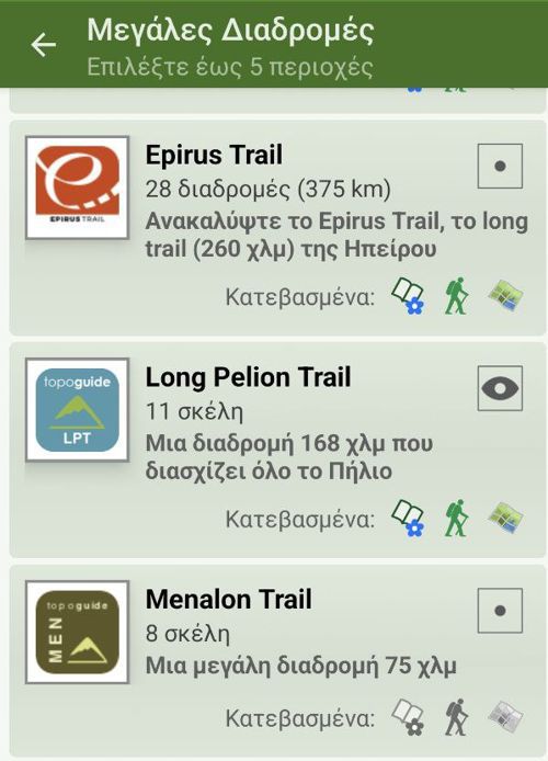
The best hiking guide for Mt Hymettus is the application topoguide Greece, which is available for Android devices, as well as for iOS (iPhone and iPad) devices. On both platforms, Mt Hymettus is available as an in-app purchase in the Attica group.
Mt Hymettus topoguide offers maps, descriptions and photos for more than 70 routes, spreading across North, Central and South Mt Hymettus. Routes include all Points of Interest of their immediate vicinity. The app recognizes the nearest hiking route and suggests the user to actively guide him along it.
Mt Hymettus topoguide routes are clustered around major starting points. The presentation starts with the routes around the monastery of Kesariani, which are undoubtedly the most popular ones, and continues with the routes around Papagou suburb, the second most popular gate of the mountain. Another group of well known routes starts from the monastery of Agios Ioannis Kynigos, a nice place, frequently visited by the residents of the surrounding suburbs Cholargos and Agia Paraskevi.
In the middle of the western side of the mountain there are two more groups of hikes, the routes over the Kareas monastery and the neighboring routes around the Koutala monastery, while further south several long trails start from Ilioupoli.
In South Hymettus, a small group of routes start from Terpsithea, while the routes that cross the eastern slopes of Mt Hymettus have as starting point the small town of Koropi.
Finally, a group of long trails and crossings are presented independently, since due to their requirements they enter the field of mountaineering.
SPAY network Trail
The natural starting point of the hiking routes of the Nort Mt Hymettus id the monastery of Agios Ioanis Kynigos. There is a convenient parking lot in front of the monastery. The routes are well-marked and well-trodden.
Major routes starting form the monastery of Agios Ioanis Kynigos:
- SPAY Net Route 2: A loop trail in Korakovouni.
- SPAY Net Route 3
- SPAY Net Route 5
- SPAY Net Route 7
- SPAY Net Route 8
- SPAY Net Route 10
- SPAY Net Route 10a
- SPAY Net Route 11: A loop trail around Agios Ioanis Kynigos monastery.
- SPAY Net Route 12
- SPAY Net Route 13
- SPAY Net Route 14
- SPAY Net Route 15
Trails around Kessarianis monastery
Kessarianis monastery is accessible either from Papagos (via Anthousa tower) or from the Kessarianis interchange, under Attiki Odos (there is often a control at the local fire station).
There is a relatively small parking area at the upper junction of the two one-way branches of the circular road, near the entrance of the monastery (parking along these two branches is pretty unsafe). Five cars can be safely parked near Kalopoula recreation area (800 m from the entrance of the monastery); A space for another 10 vehicles is available at the entrance of the first dirt road (2.2 km from the entrance of the monastery).
The hiking terrain around the Kessarianis monastery are endless, as either hikers or cyclists constantly discover some connection. The area is ideal for walks, hiking, introduction to nature, playing and gentle cycling. Cyclists, please note that there are quite a few visitors on the weekends and some care is required - and quite a few polite nods.
The following hiking routes around the Kessarianis monastery are a simple introduction to the area.
- Kessarianis monastery lesser loop trail: An easy walk for everyone.
- Kessarianis monastery major loop trail: An easy hike.
- Kessarianis monastery ascending trail: Somewhat strenuous walk.
- A walk from Kessarianis monastery to Kalopoula: A nice loop trail.
- Lower loop trail around Taxiarches hill: An easy walk across the conifer forest.
- Kessarianis monastery-Evzonas peak
- Kessarianis monastery-ancient quarries: A short hike across the antique land.
- Kessarianis monastery-Kalopoula: A longer variation.
- Kessarianis monastery-Karea suburb: A long yet easy trail.
- Kessarianis monastery-Summit: A long, tiring course.
Trails starting from Papagou suburb area
The Papagou area is a very convenient starting point for entering the Mt Hymettus hiking kingdom, as the suburb is very close and it is well served by buses.
The road connecting Papagou to the cemeteries of Cholargos and Papagou passes under Attiki Odos motorway and leads to the dirt road network of northern Mt Hymettus and to the road of Evzonas. There are several parking places along the road, so you can leave your car at an appropriate spot and continue on foot or by bike.

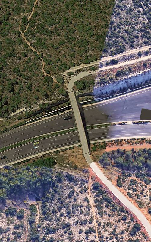
Η υπερυψωμένη διάβαση πάνω από την Αττική Οδό
Another interesting feature of the trails that start from Papagou is that going through the official entrances (e.g. Kessarianis monastery, Cholargos/Papagos cemeteries, Agianis Kynigos monastery, Koutouki Cave etc) is not mandatory: one could cross the Attiki Odos motorway by the elevated passage near the Attiki Odos tolls, the reforested cut-and-cover passages in Petrokorakas and Cholargos or the drains tunnels.
The hiking routes starting from the Papagou area are shown in the table below:
- Papagou-Asteriou monastery: A mild ascent to Asteriou monastery.
- Korakovouni loop
- Athletic loop along Korakovouni
Trails starting from Koutala monastery
Hikers can enter the densely wooded area of Koutalas monastery from the access road of the sports facilities of Vyron municipality.
The Koutalas recreation area benefits of a dense pines and cypresses wood, however it seems that the place have lost its naturalness. Several alleys and paths cross the area in destination to the ancient quarries, the valley of Keasariani or the monastery of Karea. Main hiking routes are listed below:
- Koutalas monastery loop trail: Interesting spots.
- Koutalas monastery-Kareas monastery: An easy walk in the woods.
- Kessariani monastery-Kareas: An easy yet quite long crossing.
Trails around Kareas monastery
The slopes above the Karea monastery have been burned several times over the last decades and undoubtedly their current appearance does not encourage the hiker to wander along the paths. Still, the savvy hiker can cross the burned zone and reach the stony slopes of the ridge. The family or the lonely walker can wander the forest road to Ilioupolis. On the other side of the monasery, one can enter the well-trodden cycling and hiking trails towards the Kessarianis monastery.
Note that the wildfires may have obliterated the markings, which are periodically updated with fair means by the friends of the mountain.
Leave the car in the small parking lot of the Kareas monastery (the bus stop is not far either) and select on of the following trails:
- The cyan loop around Kareas monastery: A pleasant loop trail.
- The short loop at Kareas monastery: Kareas monastery-Mt Hymettus mountain refuge and back.
- Kareas monastery walking loop<: A gentle walk around the Kareas monastery.
- Kareas monastery-Michailidis memorial
- Koutalas monastery-Kareas monastery
- Kessarianis monastery-Kareas monastery: A long yet easy hike.
- Red loop at Kareas monastery: Kareas monastery-Kathistiko-Gidospilia cave.
Trails starting from Ilioupolis
The recreation area of Prophitis Ilias Ilioupolis (parking lot) is a little known yet very convenient starting point for the exploration of Hymettus. The location give access to the entire network of hiking routes of central and southern Hymettos.
From the bus terminus (upper end point of Venizelos avenue) one can enter the network of dirt roads of central Hymettus and make pleasant walks towards the Karea monastery, Astynomika suburb and Argyroupolis.
At last, the rocky terrain of these slopes challenges the naturalist to wander in search of the very interesting flora species, across a dramatic landscape of ridges and steep ravines.
The richness of the trails starting from Ilioupolis is reflected in the following table.
- A walk around Profitis Ilias Ilioupolis
- Profitis Ilias Ilioupolis-Michailidis memorial
- Ilioupolis-Sfittos
Trails starting from Koropi
Koropi is the largest settlement attached to Mt Hymettus. The city preserved many links with the mountain, where the chapels replaced the ancient sanctuaries and the 19th c. mines continued on the same location of the ancient iron mines.
Inevitably, therefore, trails starting from Koropi to Mt Hymettus follow the traces of the ancient tracks that criss-crossed the mountain, such as the famous Sfittia Odos, the ascent to the great sanctuary of Zeus - today the plateau of the Prophet Elias - and the road to the Roman era quarry.
The main trails from Koropi to the passes, the plateaus and the peaks of Mt Hymettus are:
- Chalidhou-Evzonas: Ascent of the steep eastern spur.
- Chalidhou-Sessi plateau: On the old path to Sessi plateau.
- Sfittia Odos-sanctuary of Zeus Omvrios: On the ancient path to the sanctuary.
- Sfittia Odos-Roman quarry: Following he ancient road to visit the Roman quarry.
- Ilioupolis-Sfittos
- Sfittia Odos: The ancient way from Athens to Sfittos.
- Terpsithea-Koropi: Terpsithea-Stroma-Mavrovouni-Stavros-Koropi.
- From the summit to Sesi: A loop trail to Sesi plateau.
Trails around Terpsithea
The Terpsithea suburb surrounds Mt Hymettus SE slopes. Among various possible trails in this area, the most interesting are:
- Terpsithea-Stravaetos peak
- Profitis Ilias (Terpsithea): Profitis Ilias-Isoma peak-Mitromaras cave-Terpsithea.
Long trails and crossings
Dispite the division of Mt Hymettus into distinct sections, separated by deep passes or plateaus, its elongated shape challenges the hiker to combine several longitudinal trails and compose long routes, in most cases in a North to South direction. The oldest of these routes is the famous Route 10 and the much shorter Route 5. There is also an easier variant of Route 10, the Route 10 short version, which avoids the Kessariani valley, while keeping the starting point and destination of the "integrale".
In a wider perspective, the multitude of well-trodden trails allow the experienced hiker to compose many other combinations, either longitudinally, from Agios Ioanis Kynigos to Vari, or transversely, from Chalidou to Kessarianis monastery or Ilioupoli. The roughness of the terrain, the time span of the hike and the several logistic issues (water, exposition to the elements) along these routes are similar to those faces during long traverses on much higher mountains.
The table includes the three most popular crossings and some more routes:
- The Great Crossing: The completed crossing of Mt Hymettus.
- SPAY network Trail 5
- Route 10 - Long versio: Agia Paraskevi-Evzonas-Stavros-Terpsithea.
- Route 10 - Short version: Agia Paraskevi-Evzonas-Stavros-Terpsithea.
- Terpsithea-Koropi: Terpsithea-Stroma-Mavrovouni-Stavros-Koropi.
- Route 5
Text & photos: T. Adamakopoulos

topoguide Greece
A guide to Mt Hymettus

Mt Hymettus topoguide is available for Android devices as one of the dozens of available region of Greece via the topoguide Greece application. Mt Hymettus topoguide is a member of the Attica group. Get the Mt Hymettus guide as an in-app purchase through the app.
Mt Hymettus topoguide is also available for iOS (iPhone & iPad) devices via the application Topoguide Greece. Get the Mt Hymettus guide as an in-app purchase through the app, found in the Attica group.
topoguide Greece offers active navigation along the trails, as well as a comprehensive guide to the geography, the nature and the culture of the area.

