Ancient and medieval monuments of Kefalonia
Cultural and historic outline of Kefalonia
Ancient and medieval monuments of Kefalonia
The local timeline
The established human presence dates from the Paleolithic era, as evidenced by findings from Fiskardo, Sami and Skala. The information from the Neolithic years is more abundant and based on both findings from caves (Drakena in Poros, Gerogompos in Palliki), as well as from various open-air facilities that have been identified either in the inland, or at the coast.
Over the next two millennia, the island had been gradually preparing for the "explosion" of the Mycenaean period. Indeed, the Mycenaean years (1,550-1,050 BC) is a period of great demographic and residential development, which has left us a variety of findings (houses, tombs, mobile objects) in several locations, such as the chamber-formed and domed tombs at Mazarakata, Lakithra, Diakata, Prokopata, Mavrata, Tzannata, Kontogenadha, Skineas, Metaxata and Kagelisses.
After the decay of the Mycenaean civilization, scattered residential units organized into larger, more multitudinous and better fortified settlements. In the classical years (5th-4th century BC), four city-states were formed, Krani in the center, Pali to the west, Pronnoi to the south and Sami to the east and north, altogether known as the "Cephalonian Tetrapolis". The Cephalonian Tetrapolis reached its peak of prosperity during the Hellenistic period (4th century BC - 188 BC).
During the Roman domination (189 BC-330 AD), the old cities were inevitably tossed as situations changed, new force centers appeared to the south and north, while Sami significantly enforced its infrastructure and role, as it had been a main station of the Roman Navy.
After the division of the Roman Empire, Kefalonia passed to the influence zone of Byzantium and later under the Frankish sovereignty.
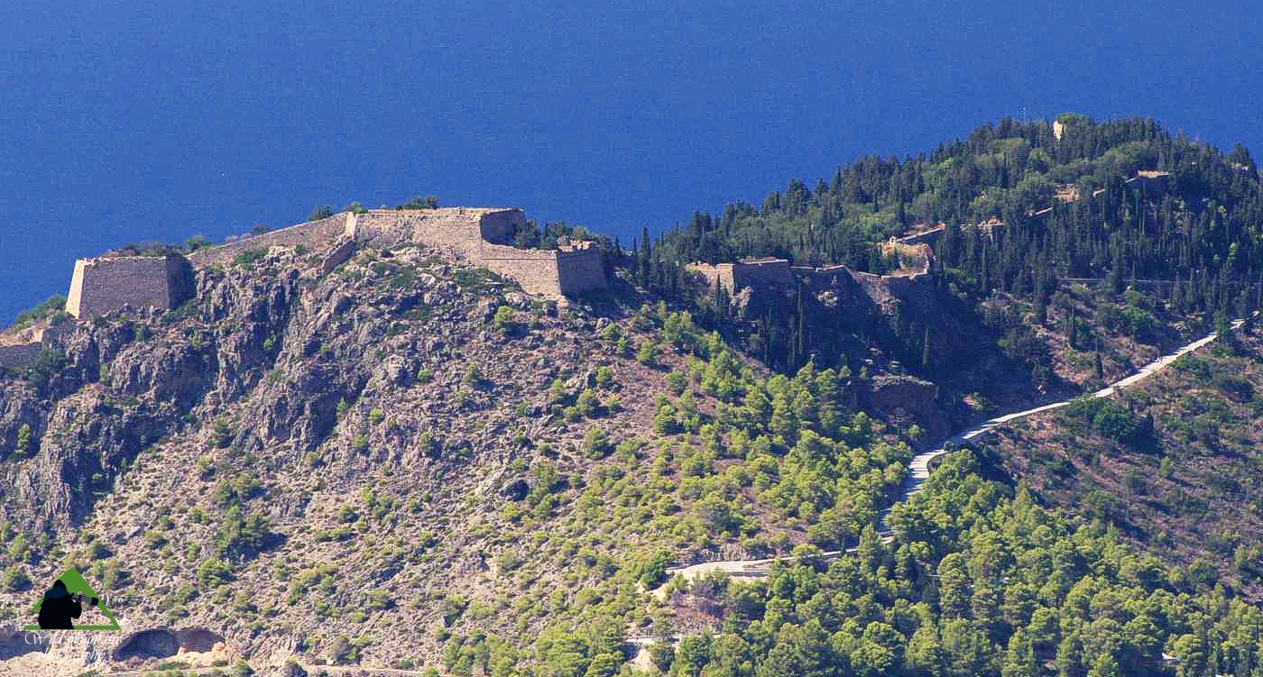
The castle of Assos
Click to enlarge
The castle of Assos
During the period 1500-1797, the island passed into the dominance of the Venetians, which showed increased interest in both its geopolitical and strategic position, as well as in its productive potential. The Venetians enforced older fortifications in the mainland, such as the castle of Agios Georghios and built new large coastal fortresses, such as the castle of Assos. At the same time, they transferred techniques and practices from the West and influenced the entire economic and social structure of Kefalonia.
In the late 18th and early 19th centuries, Kefalonia was found for a few years under French occupation, while in 1809 passed under English management, which lasted until 1864, when the Ionian Islands joined the freed Greece. An important part of social history and of the modern monuments of the island belongs to the period of British domination and is the work of enlightened European governors.
Drakena Cave
The Drakena Cave is a site of Neolithic inhabitation that has been identified inside the Poros gorge. The cave is maintained in a residual form due to the collapse of a part of its roof and today it looks more like a simple rock shelter. Preliminary investigations and systematic excavations by the Ministry of Culture brought to light remains of habitation dating to Neolithic years up to the Early Bronze Age. The cave probably was abandoned afterwards but was reused from the end of the 7th c. until the early 2nd c. B.C. as a sanctuary devoted to the worship of the Nymphs.
Beehive/Tholos tomb of Tzanata
This is the most important prehistoric tomb of Kefalonia, a large domed building with a height of almost 4 m and a diameter of about 7 m. It was discovered near Tzanata and has been excavated by the archaeologist Lazaros Kolonas in early 1990.
The tomb has been dated to the Mycenaean period. It is estimated that it has been used repeatedly between 1400 and 1000 BC, as it is known that during this period the large vaulted tombs were used for more than one dead. The size, the time span of use and the richness of the findings suggest that the area was a flourishing Mycenaean center.
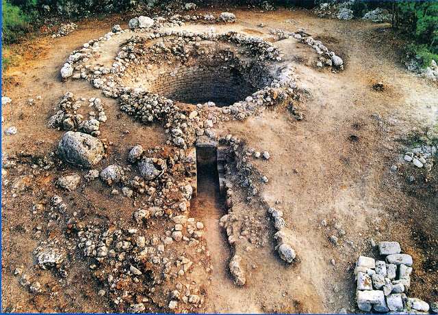
during the excavations
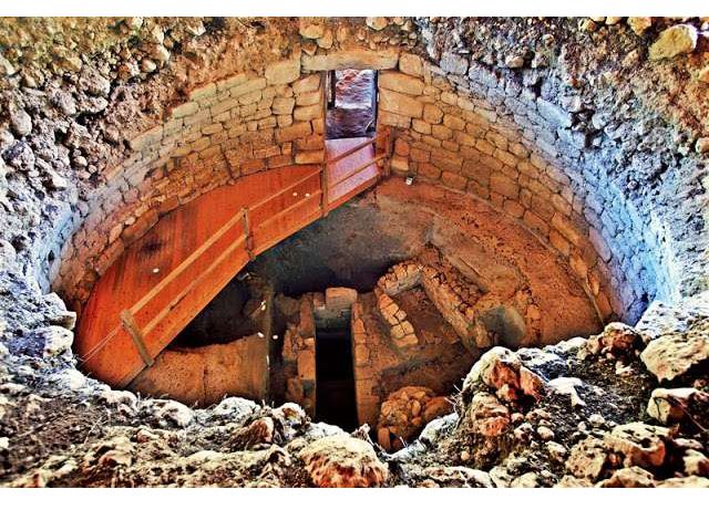
nowadays view
Although the tomb had been looted in antiquity, several findings were recovered, and among them jewelry, seals, clay figurines, miniature objects, small gold votive double ax and gilded bull horns. The findings, which reveal wealth and apparently belonged to the local gentry, are exposed to the Archaeological Museum of Argostoli.
Doric temple in Skala
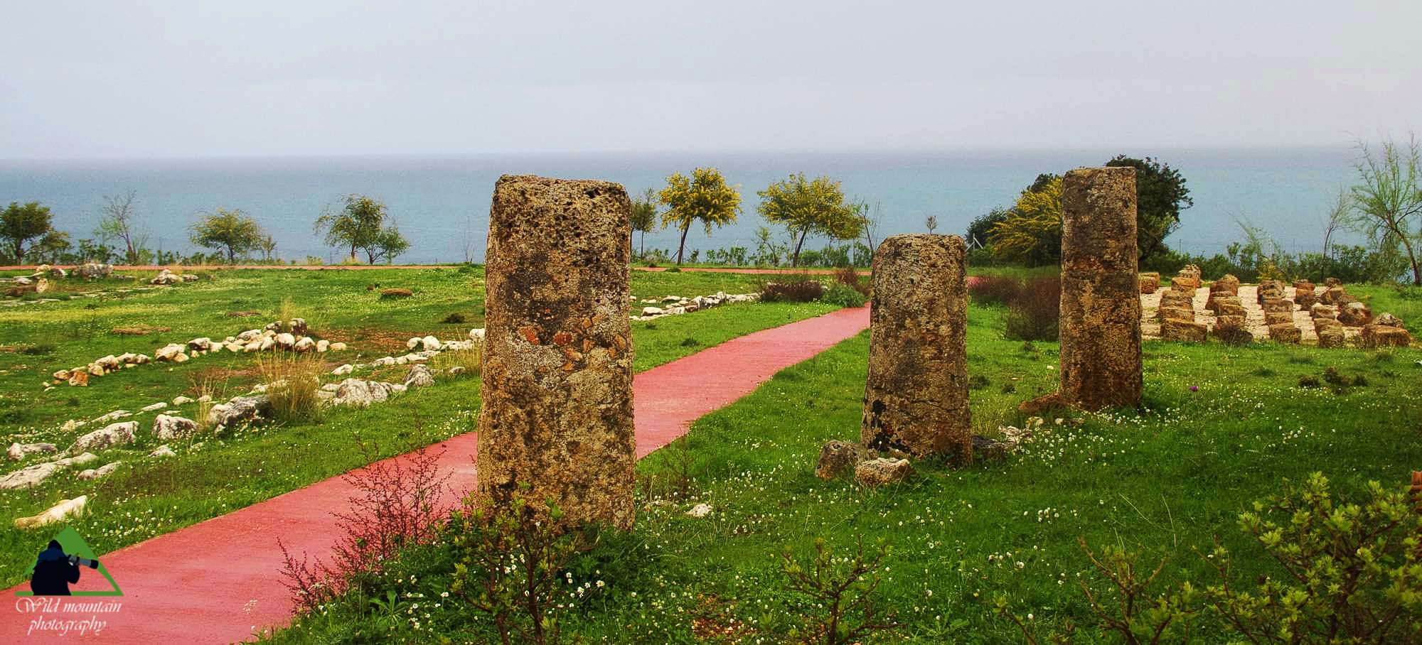
The archaeological site of the Doric temple
Click to enlarge
The archaeological site of the Doric temple
In the Skala area, near the Roman mansion and next to the chapel of Agios Georgios, in a location called Grado, the remains of an ancient temple were discovered in 1812 and excavated in 1960. The complex consisted of a Doric temple, a building and the enclosure constructions. Despite its moderate degree of preservation, the Doric temple of Skala is the most important ancient temple complex in Kefalonia.
The temple, founded at the beginning of the 6th c., seems to have been abandoned in the 4th c. BC. It belonged to the territory of the city-state of Pronnon. Its location, in the middle of the southern coast of Krania and in a prominent place, closely connected to the natural port of Poros, suggests that the temple functioned as a reference point for the navigation of the time.
Roman villa near Skala
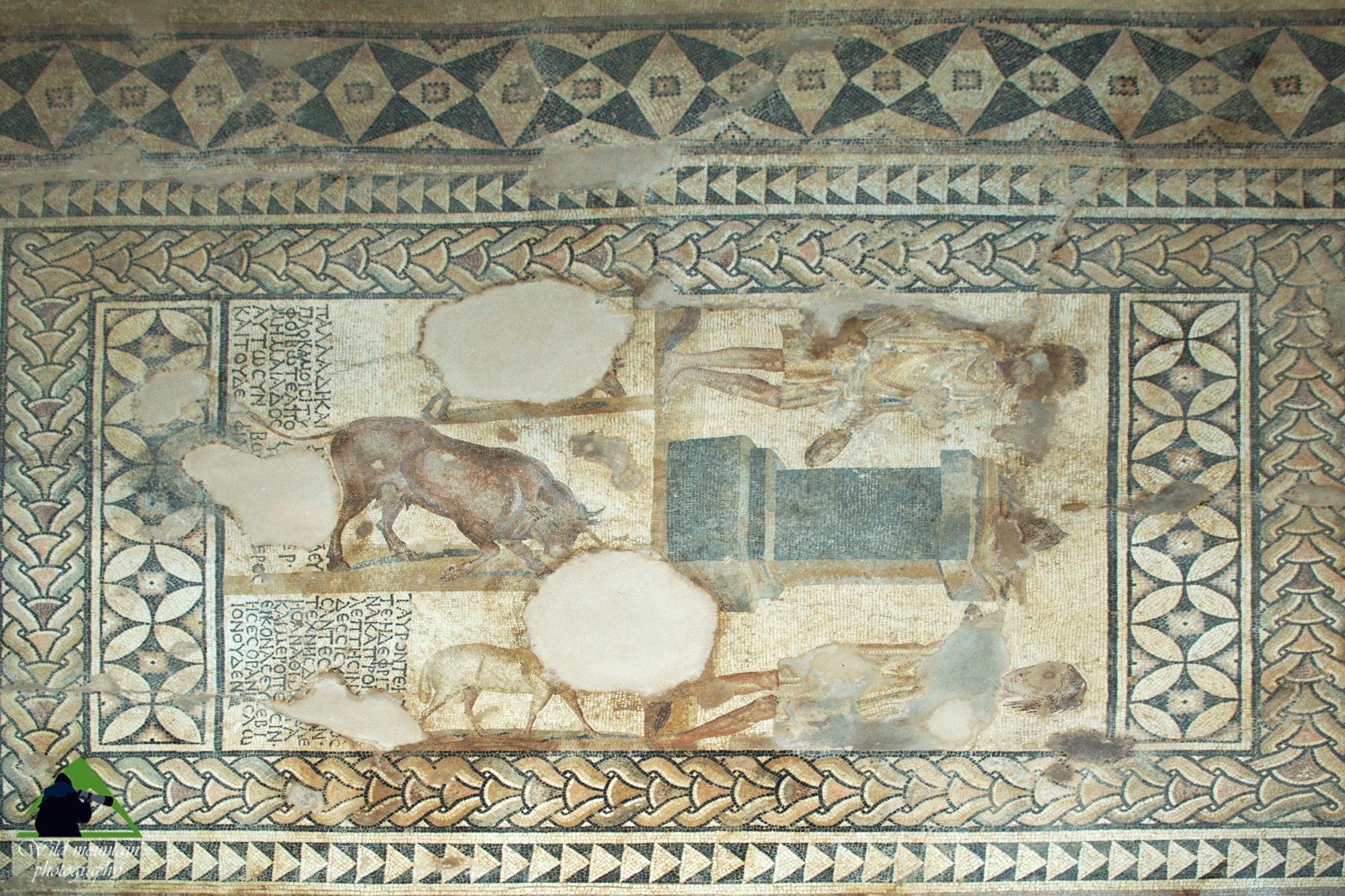
Roman villa near Skala
Mosaic floor displaying young man being attacked by two pairs of beasts, a panther and a leopard in the upper part, a tiger and a lion lower
Click to enlarge
Roman villa near Skala
Mosaic floor displaying young man being attacked by two pairs of beasts, a panther and a leopard in the upper part, a tiger and a lion lower
The Roman villa at Skala is the most important monument of the Roman era in Kefalonia and has been dated in the 2nd c. A.D. The monument has been identified in 1957 and excavations revealed a large farmhouse and open courtyard. The remains of a modern reservoir indicate the possible location of baths with hypocaust. The place of the main entrance of the building on the south side, opening to the nearby stream, supports the hypothesis of the fortified nature of the villa, as it seems that the access was through a mobile wooden bridge.
The complex is located in the village of Skala near the sea. Today we can see six rooms of the villa, between them and the outdoor courtyard. Four of the other sites have mosaic floors, colorful, decorated with geometric motifs of special artistry.
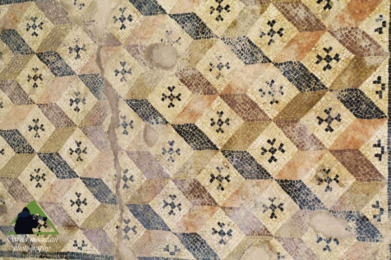
Roman villa near Skala
Mosaic floor decorated with geometric motifs
The monument can be visited. Besides the remains of the building, of particular interesting are the mosaic decorations of the floors, comprising a composition of a young man beign attacked by two pairs of beasts, a composition with altar and sacrifice scene, and two floors with geometric themes.
The building might be destroyed by fire in the 4th c. A.D. Later, on its ruins, an early Christian church has been built, destroyed by fire the 9th or 10th c. The chapel of Agios Athanasios which is now on situ dates to the late Byzantine period and has been built on the ruins of the older church.
Acropolis of Sami
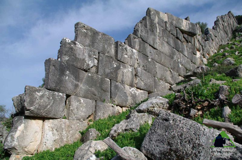
The walls of the acropolis of ancient Sami
The core of the defense system of ancient Sami, the acropolis of Sami surrounds the highest hill above the ancient (and modern) city, a place naturally protected from east and west, which however provides smooth access to the other two directions. The citadel and part of the walls are in the initial phase of the fortifications, dating from the classical period, while the tower of Kyatis and the walls completing the defensive system, have received successive improvements till the Mid-Byzantine era.
Acropolis of Kyatis
The fortress of Kyatis was part of the defense system of ancient Sami. This complex fortification, whose development extends from the Hellenistic to the Byzantine period, was composed of a large tower and two walls, connecting the tower to the main acropolis of Sami and the foreshore.
Acropolis of ancient Kranni
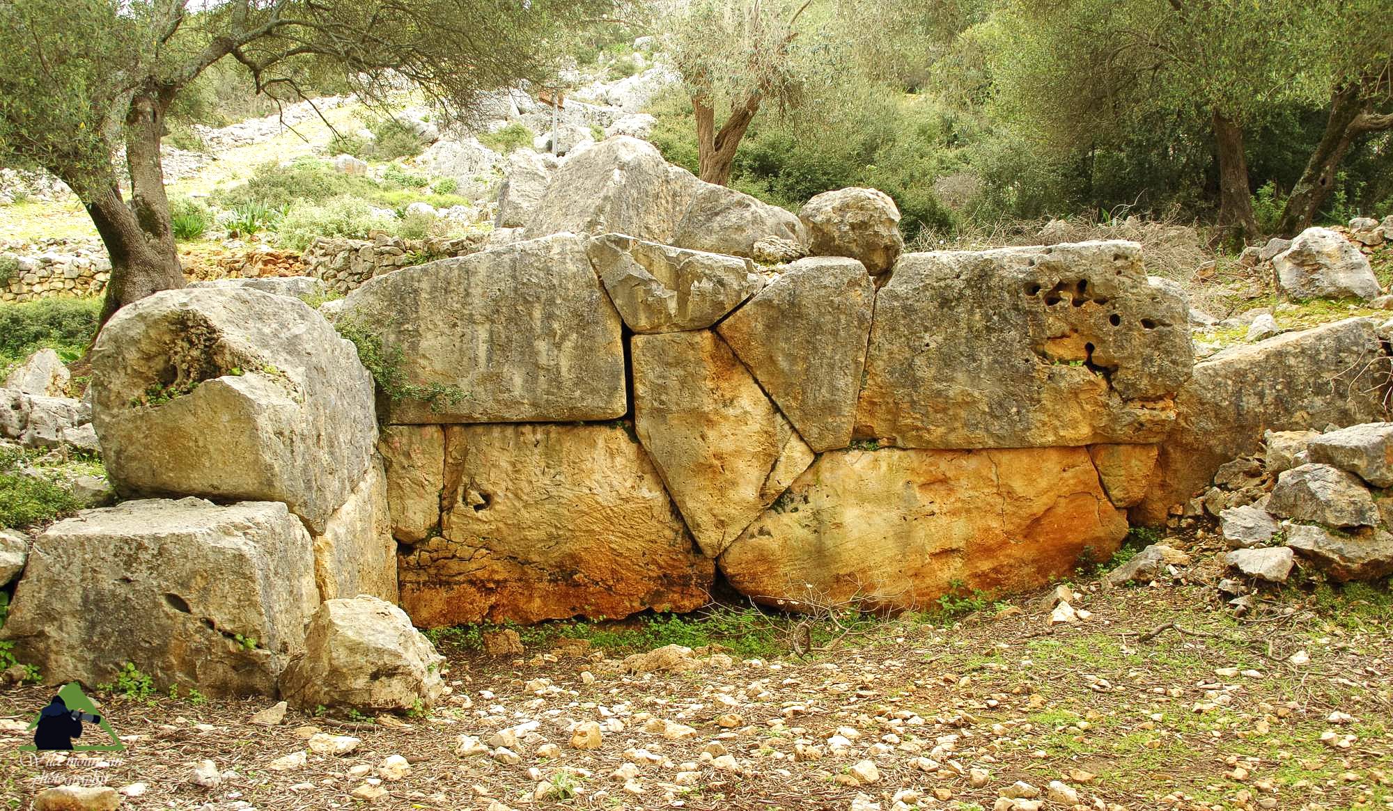
Acropolis of ancient Kranni
Cyclopean walls of the Acropolis of ancient Kranni
Click to enlarge
Acropolis of ancient Kranni
Cyclopean walls of the Acropolis of ancient Kranni
The imposing and well preserved in places cyclopean walls of the Acropolis of ancient Krani stretch in the hills of Logos and Tragalo Vouni, and access to the site is easy from the Razata (or Rosata) settlement. They were a fortification line of about 1 km long and 4 meters wide and were built to protect the town of Krani, spreading on the hills of Pezoules and Kasteli east, from the disputing town of Sami.
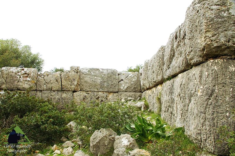
Acropolis of ancient Kranni
Trapezoidal walls of the Acropolis of ancient Krani
The wall is built by huge carved polygonal and trapezoidal blocks (both techniques have been used in its construction).
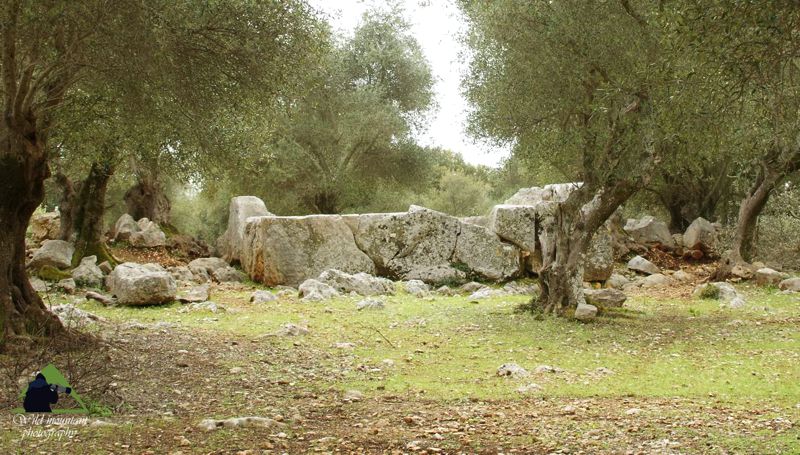
Acropolis of ancient Kranni
The two gates of the walls (‘dipylon’)
At the lowest point between the two hills, the two gates of the walls (‘dipylon’), which were the main entrances to Krani (there were also some minor along the wall), are visible.
It is also easy to see the towers of the walls projecting to the external side, especially in the southern part which is clearer, while the northern is largely covered by vegetation.
Paliokastro-Acropolis of Pronni
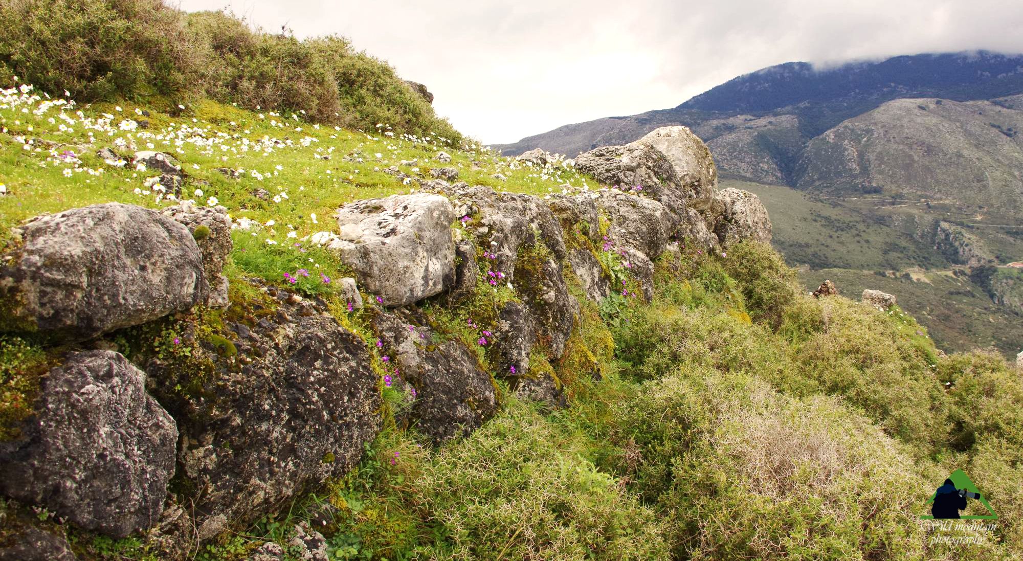
Paliokastro-Acropolis of Pronni
A section of the walls
Click to enlarge
Paliokastro-Acropolis of Pronni
A section of the walls
Paleokastro was the acropolis of the prehistoric phase of the city of Pronni, one of the four cities of Kefalonia. The city, probably located at the foot of the hill, used as a seaport the area around Poros and remained inhabited until the Hellenistic period, as evidenced by the remarkable necropolis found in the base of the hill. In the citadel stands the "throne", possibly a prehistoric altar.

Acropolis of ancient Kranni
A section of the walls
Roman baths in Fiskardo
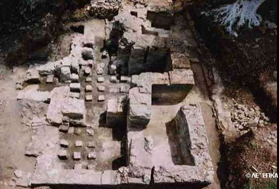
Το Ρωμαϊκό Βαλανείο στο Φισκάρδο
The private baths of Roman period were discovered near the church of Agios Andreas, next to the sea. The area has been confirmed by archaeologists that was the urban center of that period. In baths there were three hypocaust areas used for heating water and chambers.
Castle of Agios Georgios
Built on a low but prominent and relatively steep hill, under the feet of Mt. Aenos and in the middle of the fertile valley between Lakithra and Karavados, {b}the Castle of Saint George{/b}, was constructed in the 12th c. by the Byzantine emperors to be the core of the island's capital city. During the brief period Kefalonia was occupied by the Turks (1484-1500), the castle has been the mainstay of the defense. Its recapture, by the united Venetian and Spanish forces marked the final departure of the Turks from Kefalonia. The Venetians repaired and reinforced the walls, within which settled the nobles.
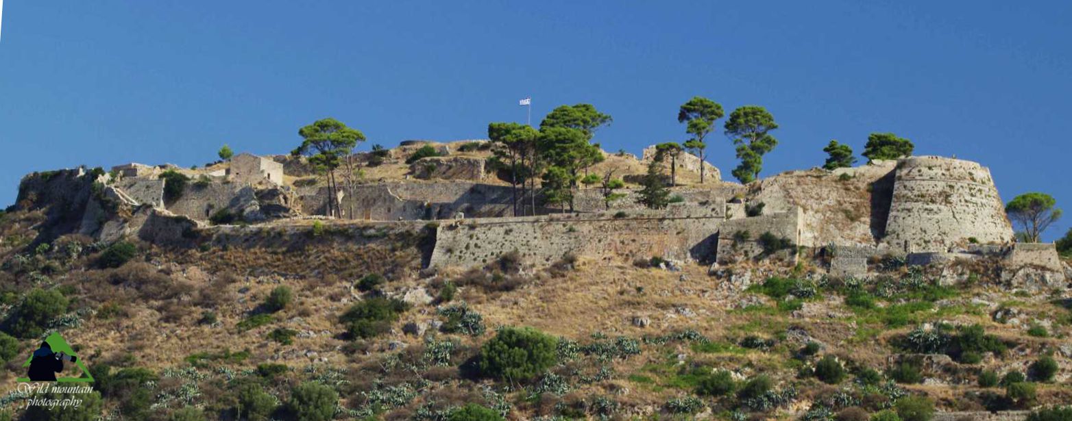
Eastern side of Agios Georgios Castle
Click to enlarge
Eastern side of Agios Georgios Castle
The location, in the heart of a densely populated and rich area and at a safe distance but not far from the sea, has proved a good choice for those times. The Venetians maintained the prominent role of the citadel as long as till 1757. This year they transferred the seat of the government to the newly and rapidly growing Argostoli. Meanwhile, in early 16th c. Venice began to construct strong coastal forts, trying to prevent the invasion of pirates and other enemies, instead of organising a defence behind the walls.
The castle occupies a total area of 16000 sq.m , with a perimeter of about 600 m. It took its name from a pre-existing church of St George. Almost all visible walls is of the first Venetian period (1504). Inside the walled area, several old churches and buildings, the remains of a structure that bridges the ramparts, the Orthodox parish church of Evagelistria and the catholic church of Saint Nicholas, can be identified.
The castle was inhabited, both inside and outside the walls, until the mid-20th c., when the buildings suffered heavy damage from the earthquake of 1953. Today, both houses and public spaces around the castle are protected and perfectly retain the character of the era.
Castle of Assos
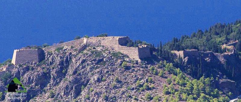
General view of the castle of Assos
The castle of Assos was founded in 1593 as an important link in the chain of defence of the Venetian colonies against the Turks and pirates. The very long and strong wall surrounded an area of 440 acres on the steep promontory of Assos, in a position where already there were ruins of an ancient citadel. The huge project was completed in just two years, under the technical guidance of engineer Marino Gentilini (who has since settled permanently on the island, founding both the castle of Assos and the kefalonian family of Gentilinis). In its final form the wall has a length of approximately 3,000 m, four gates and five bastions.
Through the plan of the castle, Venice wanted to create a fortified city, to insure local people and in parallel support the viability of the fort. So, mandates and incentives ware given to people of the area to colonize the castle. The response was quiet restrained and one hundred years later, just 39 families had resided in the castle, while "the Streto", the settlement built in the neck, had attracted much more people. The main reason for the Kefalonians not wanted to settle in the fortified area was the lack of water.

gravure
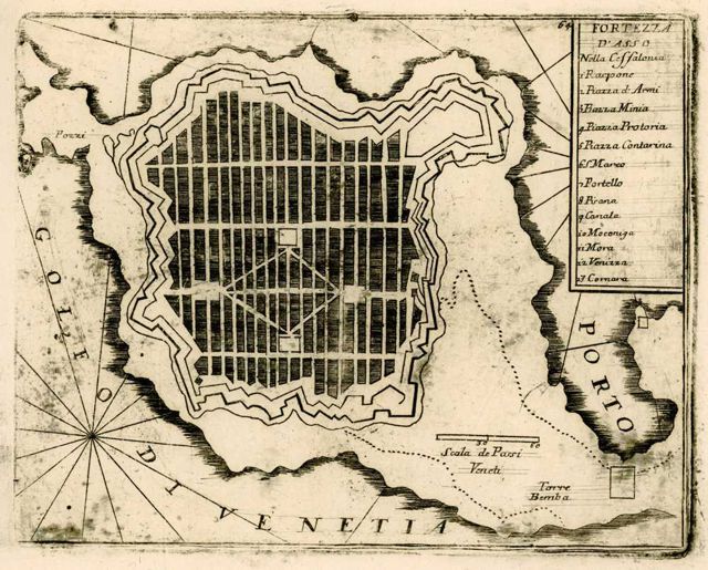
land occupation plan
So the castle of Assos remained understaffed and after 1757, when the Venetians founded Argostoli and establish the new capital of the island there, residents will gradually leave. The barracks, the residence of the Intendant, the three Catholic churches (Saint Mark, the Virgin and Saint John) and dozens of other buildings, were slowly devastating. In the mid 19th c., over the remains of an older chapel, a new parish church was built, dedicated to Profitis Ilias and decorated with beautiful wooden iconostasis and frescoes of fine art.
Much later, in 1929, the castle will be transformed into a Rural Prisons of the Greek state. Today it remains an important monument of Ionian Islands, witnessing the high technique of the fortifications of the 16th c.
Fiskardo Venetian fort
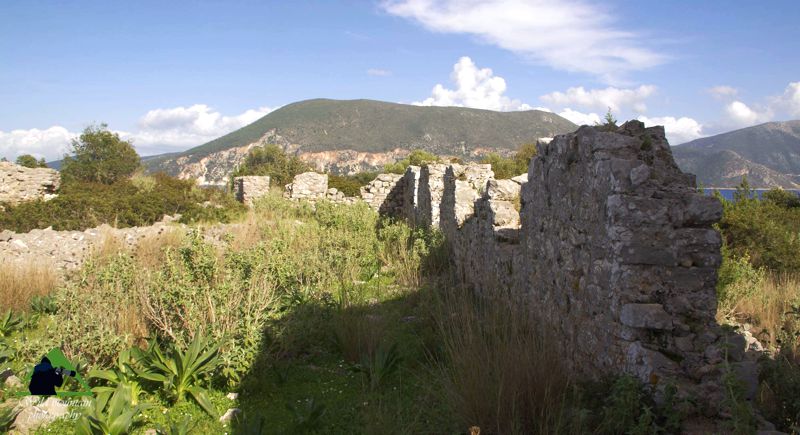
Fiskardo Venetian fort
A fortress of the Venetian domination consisting of two towers and the defensivw wall. The building of the adjacent Early Christian basilica was part of the fortification. The fort controlled the entrance of the Fiscardo harbor, but it also had enough space to serve as a shelter in cases of raids.
Fiskardo Venetian Lighthouse
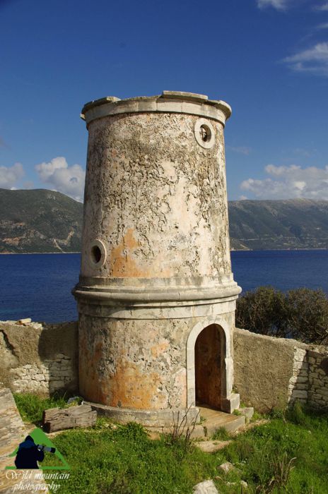
Fiskardo Venetian Lighthouse
The leeward bay of Fiskardo and the neighboring Foki bay are the safest natural harbors in northern Kefalonia. The Venetians, being in need to dock their merchant and war galleys in the region, built in the 16th c. this important lighthouse on the cape of Fiscardo. The cylindrical tower has a robust construction with a reinforcing ring in the middle, while the guardian's house is surrounded by a strong stone wall of 2 m high.

topoguide Greece
Kefalonia hiking,
nature and cultural guide
The guide Kefalonia topoguide is available for Android devices along with dozens of other regions of Greece, within the general application topoguide Greece. Kefalonia topoguide is a member of the Greek Islands group. Get Kefalonia topoguide as an in-app purchase from the topoguide Greece available regions list.
The Kefalonia topoguide guide is also available for iOS devices (iPhone and iPad) through the general hiker application Topoguide Greece. Get Kefalonia topoguide as an in-app purchase via the available regions list.
It is very interesting that topoguide Greece has the ability to simultaneously display up to 15 different areas, thus allowing an overall view of the Greek Islands and the easy alternation of hundreds of hiking routes, hundreds of Points of Interest and dozens of pages of the guide with innumerable photos.
