Mt Pelion topoguides
Pelion topoguides
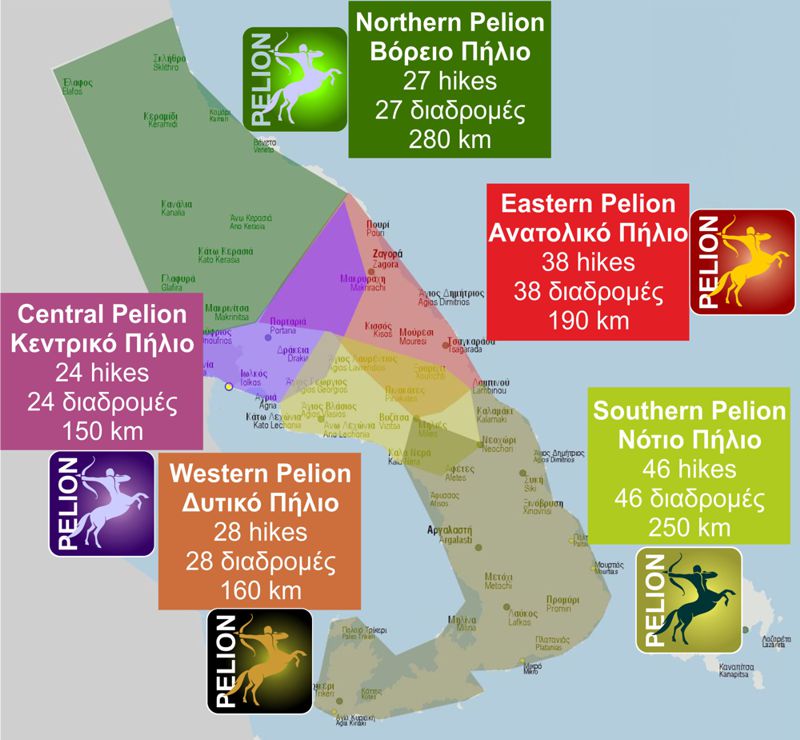
Mt Pelion hiking network is covered by 4 guides of the topoguide family. The coverage of each guide correspond exactly to the distinct geographical entities of the peninsula: North Pelion topoguide (Keramidi to Pouri area), Central Pelion topoguide covers the Volos-Makrinitsa-Chania area, West Pelion topoguide covers the area from Lechonia to Milies, East Pelion topoguide covers the Zagora and Tsagarada area and South Pelion topoguide covers the southernmost part of the peninsula, from Neochori to Trikeri.
North Pelion topoguide
trails
km of hikes
POIs
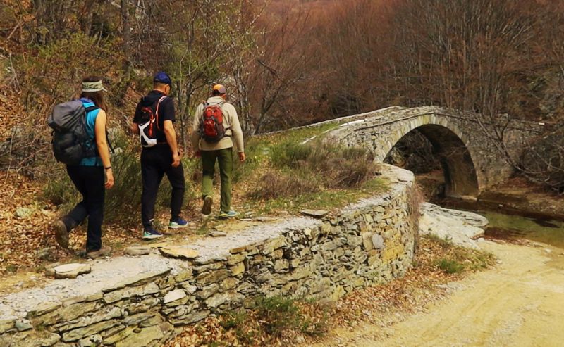
To the north of the peaks of Mt Pelion streches a large semi-mountainous area, with an amorphous yet complex terrain. To the south, this large zone takes contact through Makrinitsa to the Volos area, while to the west it is now adjacent to the reborn Lake Karla. To the east it faces, like the whole Magnesia peninsula, the Aegean Sea, while to the north it continues with Mt Mavrovouni and connects to Mt Kissavos.
The natural resources of the area, agricultural, forest and water, are limited, scattered and hidden within the landscape. The geography of the villages of North Pelion reflects the stiftness of this wild and astrigent natural frame, where a human history of centuries wea able just to add a few minor scratches.
The natural environment shares many common elements with the main Mt Pelion zone, and adds a large mature oaks woodland, a characteristic landscape of the area.
From the hikers perspective, North Pelion was until recently known only to the small world of members of Volos Alpine Club. Due to the abrupt and deep abandonment of agricultural activities, the paths of the area were closed or forgotten, to be recently revived through the development of the Volos municipality hiking project and the creation of the Long Pelion Trail.
The best hiking guide for this great area is North Pelion topoguide, which includes 16 hiking trails, with a total length of 120 km.
The guide also offers a detailed guide to the geography, nature, villages and monasteries of North Pelion as well as several hundreds of Points of Interest, most of which are associated to the hikes.
North Pelion topoguide is available as an in-app purchase for Android devices via the application topoguide Greece. North Pelion is a member of the North Greece region.
North Pelion topoguide is also available as an in-app purchase for iOS (iPhone και iPad) devices via the application Topoguide Greece, as a member of the North Greece region.
Central Pelion topoguide
trails
km of hikes
POIs

Mt Pelion is the southernmost member of a long mountain range that starts from the northern borders of Greece and through the mountains of Central Macedonia culminates at Mt Olympus. The range entends south through Mt Ossa and Mt Pelion and ends at Mt Tisseon, a satellite of Mt Pelion.
The predominance of hard-to-erode rocks give the most of Mt Pelion a gentle relief with mild slopes. An exception is the NW part of the mountain, between Kato Kerasia and Makrinitsa, a zone consisting mainly of limestone, which has relatevily steep slopes.
In this very zone lies the highest point of Mt Pelion, the Pourianos Stavros peak, which reaches 1624 m.
The villages of Central Pelion are articulated around the large urban complex of Volos. The area includes many settlements, among which some of the most popular ones, such as Makrinitsa and Portaria. Thanks to the appeal of Volos and the Pelion Ski Center, all the villages of the area are very active socially and economically, throughout the year.
Beside the impressive natural scenery, the beautiful view of the Pagasitikos Gulf, the mild climate and the many aspects of landscape, more than 100 km of trails have been preserved and waymarked in the area.
The best hiking guide for this great area is Central Pelion topoguide, which includes 25 hiking trails, with a total length of 180 km.
The guide also offers a detailed guide to the geography, nature and culture of Central Pelion as well as several hundreds of Points of Interest, most of which are associated to the hikes.
Central Pelion topoguide is available as an in-app purchase for Android devices via the application topoguide Greece. Central Pelion is a member of the Central Greece region.
Central Pelion topoguide is also available as an in-app purchase for iOS (iPhone και iPad) devices via the application Topoguide Greece, as a member of the Central Greece region.
West Pelion topoguide
trails
km of hikes
POIs

West Pelion covers the side of the mountain range of Pelion that faces the Pagasitikos Gulf and extends from Agria, ie the southernmost limit of the urban system of Volos, to Milies, last village before the zone of Southern Pelion.
The older villages of the area developed close to the mountainous resources and more preceisely near the large springs. All these villages, however, created lowland siblings near the Pagasitikos coast, through which they expanded their possibilities and especially the ways of transporting their agricultural products.
For the prosperity of this very rich in acricultural products region, the construction and operation of the old railway line Volos-Milies was realy decisive. After WWII, this small train, still maintaining a great part of the original ambiance, has been turned into a tourist attraction.
Before the development of the train, communication and transportation in the villages of West Pelion were served by a grid of exceptionally well built cobbled paths, which interconnected the villages and ran along the slopes to the local small sea ports. These cobbled paths have today become part of an extended hiking network, which is maintained thanks to local groups of hikers, mainly by the the Friends of the Kalderimi of Southern Pelion.
All these paths and the resulting trails have been included in West Pelion topoguide, a versatile guide to the paths, nature and culture of Western Pelion.
West Pelion topoguide is available as an in-app purchase for Android devices via the application topoguide Greece. West Pelion is a member of the Central Greece region.
West Pelion topoguide is also available as an in-app purchase for iOS (iPhone και iPad) devices via the application Topoguide Greece, as a member of the Central Greece region.
East Pelion topoguide
trails
km of hikes
POIs
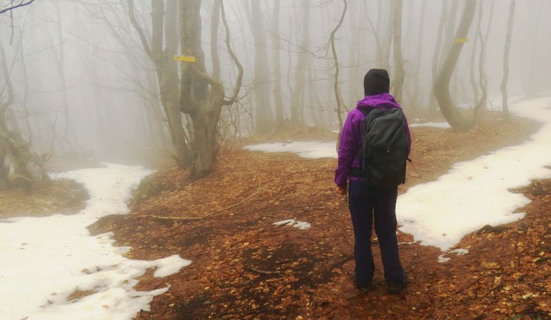
The eastern side of Mt Pelion is relatevily isolated and almost invisible from the noisy world of Volos and Central Pelion: it is a real zone behind the mountains, as the name of Zagora, the major village of the area, points out (zagora = the place behind the mountains).
The villages of Eastern Pelion are plotted along a line balanc between the difficulties of mountainous geography and the exposure to the pirates of the Aegean. Two among them are big enough to be considered as small towns: Zagora and Tsagarada.
The endless cobbled paths of the area have now been turned into hiking trails, connecting the villages of the eastern side to the villages of Western Pelion. All known trails have been included in the East Pelion topoguide, the only guide to this great area.
East Pelion topoguide is available as an in-app purchase for Android devices via the application topoguide Greece. East Pelion is a member of the Central Greece region.
East Pelion topoguide is also available as an in-app purchase for iOS (iPhone και iPad) devices via the application Topoguide Greece, as a member of the Central Greece region.
South Pelion topoguide
trails
km of hikes
POIs
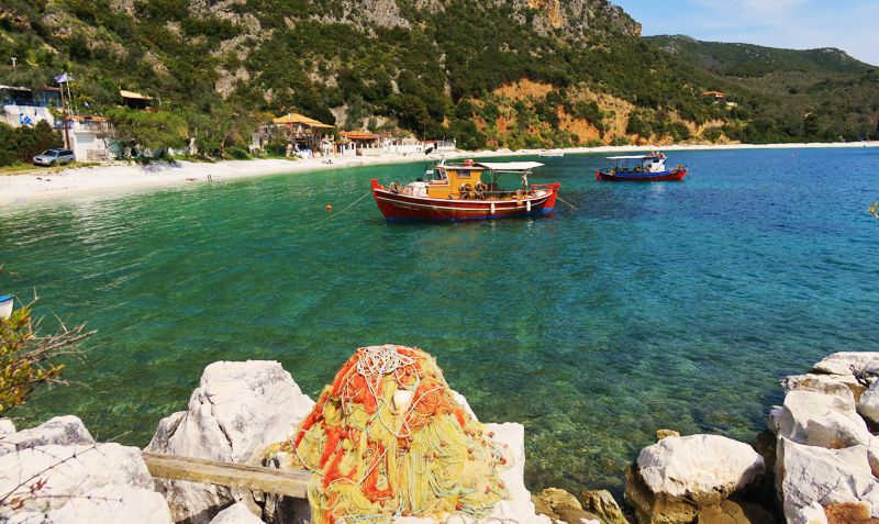
South Pelion district begins with Neochori, the northernmost village of the area, found close to the mountainous zone of Mt Pelion, and ends with Trikeri, an island-like landscape at the southernmost tip of Magnesia peninsula.
South Pelion has so many facets that it can hardly fit in a book. Only a library of unlimited capacity, such as the digital guide South Pelion topoguide could welcome the infinite aspects of this beautiful area.
South Pelion topoguide is available as an in-app purchase for Android devices via the application topoguide Greece. South Pelion is a member of the Central Greece region.
South Pelion topoguide is also available as an in-app purchase for iOS (iPhone και iPad) devices via the application Topoguide Greece, as a member of the Central Greece region.

