The Erimonissa
The Erimonissa of Alonnisos
Alonissos is surrounded by many small uninhabited islands and islets, which form a small archipelago. Many of the islands were inhabited during the prehistoric period or even in historic times, but were not permanently inhabited after late antiquity. Thus, the collective name Erimonisa prevailed - that is, "nisia" (islands) that had a human presence and were "erima" (deserted).
The closest member of this small archipelago is Peristera Island, which hides behind it a smaller island, Lechousa. Peristera island is something like a floating pastureland of Alonissos and still receives frequent visits.

Peristera Island
Click to enlarge
Peristera Island
Between Alonissos and Skopelos rise the small but extremely steep islands of Mikros and Megalos Agiorgis, while to the east lies the twins Dyo Adelfia (the "two brothers", Mikro and Megalo Adelphi) and to the north the rocky islets Moules.
Between Alonissos and Skyros lies Skandzoura Island, surrounded by the islets Korakas, Skandili, Lachanou, Polemika, Kasidis, Strogylos and Prasso, while Gaidoronisia consisting of the rocky islets Gaidaros and Polyrichos are also nearby.
Kyra Panagia Island is the largest of the Erimonissa and is surrounded by the islets Fagrou (or Pelerissa), Pappous, Koumbi, Grammeza, Melissa and Sfika.
To the north of Kyra-Panagia, Yioura Island rise steeply out of the sea, and even further into the Aegean Sea, Piperi and Psathoura with its Psathonisi sail.
Kyra-Panagia Island
Kyra-Panagia Island is the largest member of the Erimonissa Archipelago. It is located 3.5 NM north of Gerakas, Alonissos northernmost cove and has an area of 25 sq.km. The island has a mountainous terrain, with the highest point reaching 299 m. Its outline is strongly lobed, with the main indents being the open bay of Agios Petros in the SW and the deep bay of Planitis in the NE. The Planitis bay has three coves: two of them are called Endexios and Dravi.
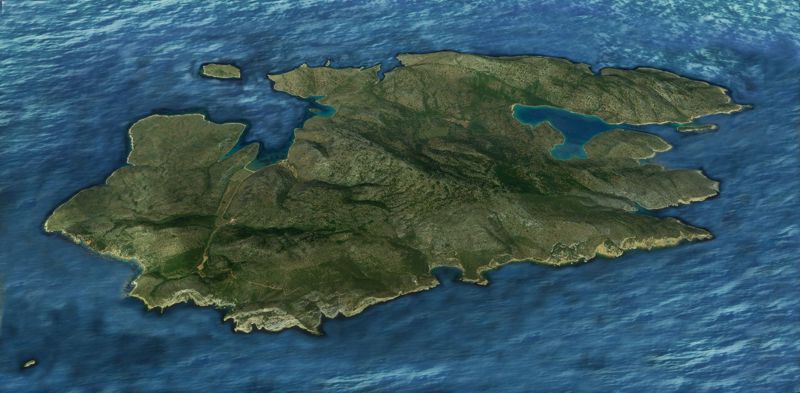
The ancient name of the island was Alonissos, while later it was known as Pelagonisi.
In 993, the Byzantine administration transferred the island to Agios Athanasios, as a dependency of the Megisti Lavra monastery, which he had already founded on Mount Athos. In the area of Agios Petros, the remains of the first monastic installation can be seen, as well as parts of an early Christian church (6th-7th c.). The existing monastery of Genesis of Theotokos was founded in the 16th c. and since then the island has been referred to as Kyra-Panagia.
The monastery is occasionally inhabited by a small male community. In the courtyard of the monastery one can see the millstones of an old olive mill, while near the monastery stands the windmill of the same era.
The vegetation consists mainly of Mediterranean maquis and phrygana, while there are large olive groves and some areas that were sown in the past. Around 3,500 goats graze freely on the island.
On the islet of Agios Petros, located in the mouth of the bay of the same name in the southwest of the island, evidences of the Neolithic civilization (6,000-5,000 BC) were found. On the shore of the bay there are remains of walls and other ancient fragments. The fortified ancient city of Alonissos was discovered in Planitis and two fortifications have also been identified. Based on the chronological sequence of the finds, it is believed that Kyra-Panagia was possibly inhabited continuously until the classical period.
Skantzoura Island
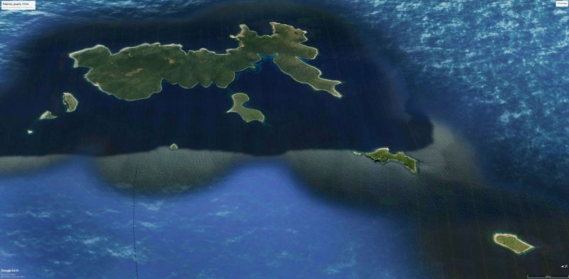
The uninhabited Skandzoura Island has an area of 6.2 sq.km.
On the island there is the Evangelismos monastery, a dependency of the Megisti Lavra monastery. The date of foundation of the monastery is not known (it is mentioned in documents from 1785).
Piperi Island
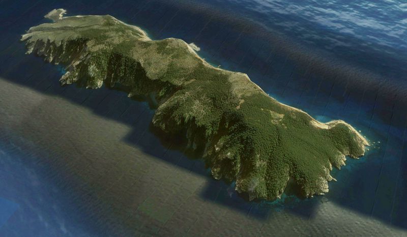
Piperi Island is located NE of Alonissos and 6.5 NM east of Yioura. The coasts are steep and the only passable access is in a small cove to the north, next to Cape Kavos. From here, a narrow path crosses the axis of the island and reaches the monastery of Zoodochos Pigis, built in the middle of a level basin, southern of the highest peak (352 m.). The monastery is dedicated to the Virgin Mary and is currently deserted.
A large part of Piperi Island is forested by stands of Aleppo pine, while the rest is covered by scrub and phrygana. Monk seals (Monachus monachus) nest in the caves of the coastline. A large number of pairs od Eleonora's falcon (Falco eleonorae) nest on the coastal liffs in the summer. Piperi Island is the core of the Northern Sporades National Marine Park and benefits the absolute protection.
Yioura Island
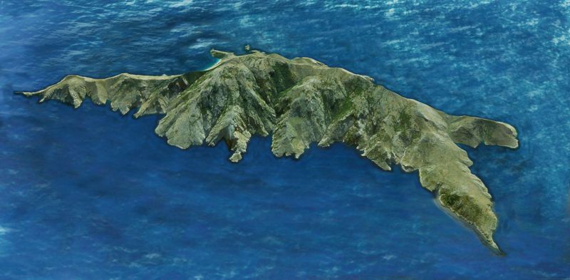
Yioura Island is extremely steep and rocky, with its highest point reaching 570 m. The vegetation consists of phrygana and stands of Kermes oak and Evergreen oak. There is a spring in the southwest. Feral goats (Capra aegagrus) live on the island, while on the cliffs nest predators such as the Bonelli's eagle (Aquila fasciata) and the Eleonora's falcon (Falco eleonorae). An important population of Mediterranean seals (Monachus monachus) lives and feeds on the coasts and sea caves of the island.
Yioura Island have been known since ancient times. Here is the so-called Cyclops Cave, the largest known cave of the Sporades. Its entrance, facing the sea, leads through a small corridor to a spacious champer, measuring 40x50 m and 15 m high. Its floor is covered with clay and there are two small lakes. Evidences of the use of the cave from the Neolithic period to Roman times were found and the findings obtained by the archaeological expeditions are extremely important.
During the post-Byzantine period, the small monastery of the Annunciation of the Virgin (17th century) was founded on the island.
Psathoura Island
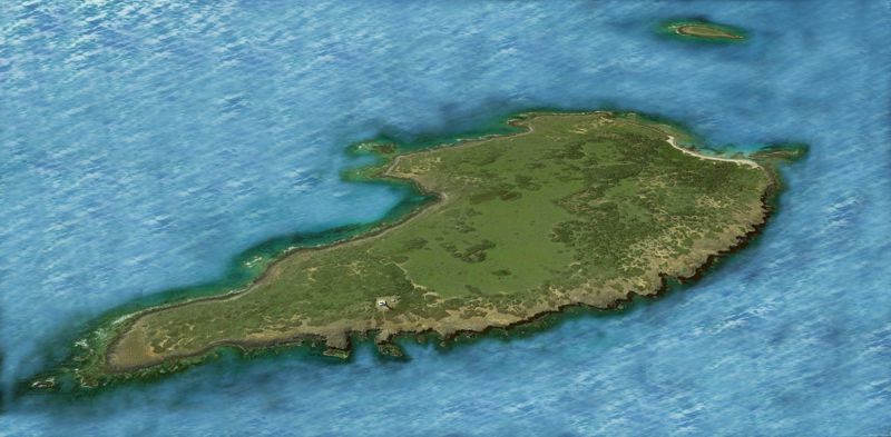
Psathoura Island is a few miles from Yioura Island. It is the northernmost island of the Erimonissa complex and one of the smallest (763 sq.m.). Unlike Yioura Island, Psathoura is almost flat (maximum elevation 17 m). It is essentially a large reef of volcanic rocks.
The only notable feature of the island is the 25 meters high stone-built lighthouse in the NE.
Text by T. Adamakopoulos

topoguide Greece
ALONNISOS TOPOGUIDE
Digital field guide Alonnisos topoguide is available for Android devices as an in-app purchase within the application topoguide Greece. Alonnisos topoguide is a member of the Greek Islands group.
Digital field guide Alonnisos topoguide is also available for iOS (iPhone and iPad) devices as an in-app purchase within the application Topoguide Greece. There also, Alonnisos topoguide is a member of the Greek Islands group.

