Zygovisti-Elati
Menalon Trail
Zygovisti-Elati

Menalon Trail
The church of Zoodochos Pigi, near Paleochori
The church of Zoodochos Pigi, near Paleochori
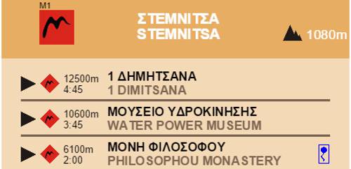
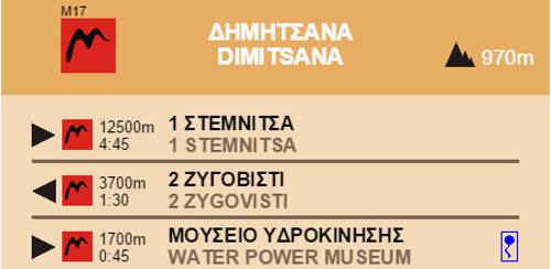
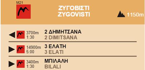
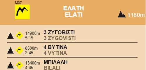
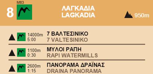
The route Zigovisti-Elati straddles the Western Menalon massif.
Leave Zigovisti behind passing by the old church of Agios Ioanis and the Piso Vrisi fountain where the trailhead wends through a beautiful ravine to the country church of Agios Georgios and the adjacent spring.

Menalon Trail
The Piso Vrysi fountain, in Zygovisti
The Piso Vrysi fountain, in Zygovisti

Menalon Trail
The chapel of Agios Georgios
The chapel of Agios Georgios

Menalon Trail topoguide
The Koskitsa trough
The Koskitsa trough

Menalon Trail
The Lygos cave
The Lygos cave

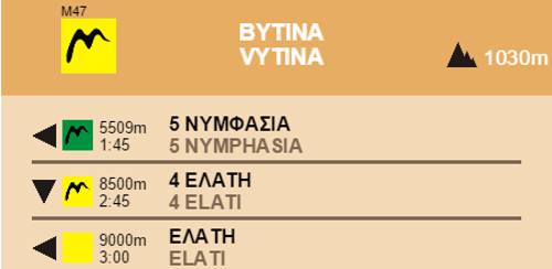
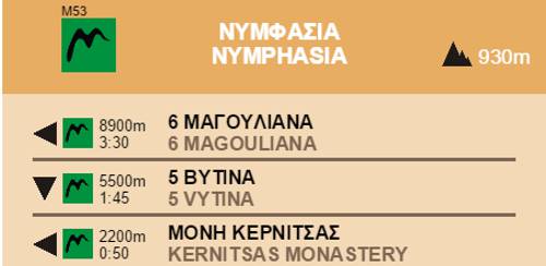
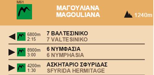
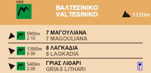
Section 3 Zygovisti-Elati
Elevation profile
Elevation profile
Text and photos by T. Adamakopoulos

topoguide Greece
Menalon Trail topoguide

All useful information about the section Zygovisti-Elati - interactive map, photos, metrics and description - is included in the digital field guide Menalon Trail topoguide.
The digital field guide Menalon Trail topoguide is available for Android devices as an in-app purchase within the application topoguide Greece. Menalon Trail is a member of the Long Trails group.
The digital field guide Menalon Trail topoguide is also available for iOS (iPhone and iPad) devices as an in-app purchase within the application Topoguide Greece. There also, Menalon Trail is a member of the Long Trails group.
Menalon Trail topoguide offers active guidance along the trail, as well as an extented guidebook on the geography, the nature and the history of the area.