Menalon Trail, Valtesiniko-Lagadia
Menalon Trail
Valtesiniko-Lagadia

Menalon Trail
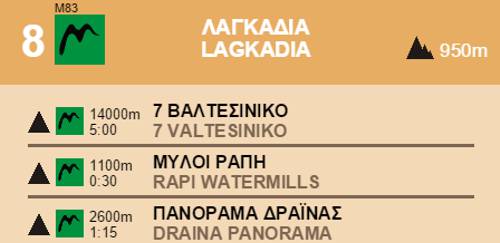
Panorama Drainas, near Lagadia
Panorama Drainas, near Lagadia
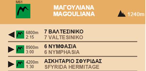
From Valtesiniko square, pass by the impressive stone built school and access the upper peripheral road of the village, from here the view overlooks all the northern plains. Gain altitude from the footpath and the cement road until 1250 meters, where the footpath becomes clearer and runs along the ridge where the byzantine fortress Kastro Valtesinikou is nested. Descend to the small country church St. Triada through open landscapes and stunning views.

Menalon Trail
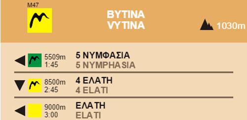
Valtesiniko
Valtesiniko

Menalon Trail
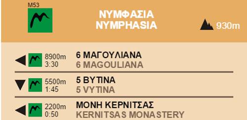
Grias Lithari spring
Grias Lithari spring

Menalon Trail
Rapi Watermills
Rapi Watermills

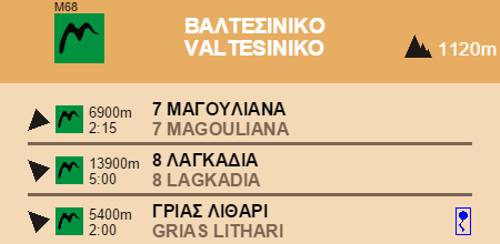
Section 8 Valtesiniko-Lagadia
Elevation profile
Elevation profile
Text and photos by T. Adamakopoulos

topoguide Greece
Menalon Trail topoguide

All useful information about the section Valtesiniko-Lagadia - interactive map, photos, metrics and description - is included in the digital field guide Menalon Trail topoguide.
The digital field guide Menalon Trail topoguide is available for Android devices as an in-app purchase within the application topoguide Greece. Menalon Trail is a member of the Long Trails group.
The digital field guide Menalon Trail topoguide is also available for iOS (iPhone and iPad) devices as an in-app purchase within the application Topoguide Greece. There also, Menalon Trail is a member of the Long Trails group.
Menalon Trail topoguide offers active guidance along the trail, as well as an extented guidebook on the geography, the nature and the history of the area.