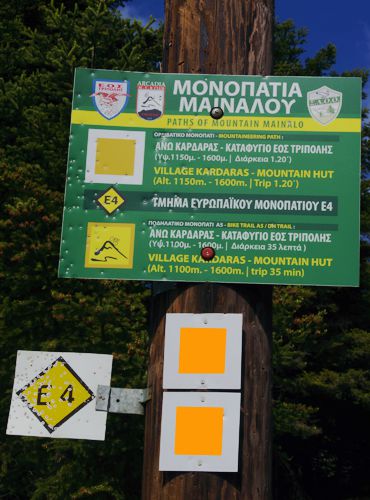
E4 Vytina-Tripoli
E4 in Peloponnese
E4 Vytina-Tripoli
The trail starts from Vytina and follows roads to the chapel of Agia Sotira. From the end of the road, enter a path, which runs through a wooded ravine. In places, the path becomes an alley and converges with the asphalt road Vytina - Mainalo Ski Center - Kardaras.
After the Mainalo Ski Center follow the road and leave it to take a path that goes through the forest and near the Troupa cave. Meet the Orange Trail and follow it to the Mainalo Ski Center, near the EOS Tripolis reafuge.
From the refuge, follow the road to Kardaras for a while. Quit the road three times, taking shortcuts on a good path through the fir forest. At the height of the Kardara settlement, leave the asphalt to take a dirt road that descends gently towards the Tripoli-Levidi main road. Follow the road up to the village of Kapsia.
< br>
After Kapsia, the E4 follows dirt roads and paths and runs through a zone of bare abandoned fields. Pass by the chapel of Agios Georgios and nearby the Epano Chrepa monastery. eventually reach Perithori, a settlement above Tripoli.
The descent into Tripoli is made along paved roads.
Text and photos by T. Adamakopoulos
Signage
Signposting & waymarking

Fortunately, in the parts where the E4 coinsides with the local network of paths, we find the marking of the local routes.

