The villages of Kardamyli
The villages of Kardamyli
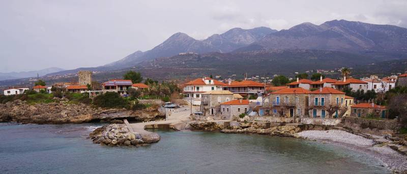
The area corresponding to the economic and social zone of influence of Kardamyli extends from the large geological recession around the town to the area of Selinitsa (today, Agios Nikolaos) and Trachila. This elongated zone consists of two parallel worlds: the series of semi-mountainous settlements, hidden in the ravines, near the great karst springs and at the base of the mountain's natural resources, and the series of coastal settlements, nestled in the few lee bays. Once prosperous, thanks to the safety of their location and the versatility of their economy, the semi-mountainous villages have today given the lead to the coastal settlements, which host almost all the tourist activity of the area. Among the latter, stand out is the case of Stoupa, which thanks to its abundant flat space, has evolved from a humble fishermen harbour to a crowded tourist pole - without however being able to claim the quality title from Kardamyli.
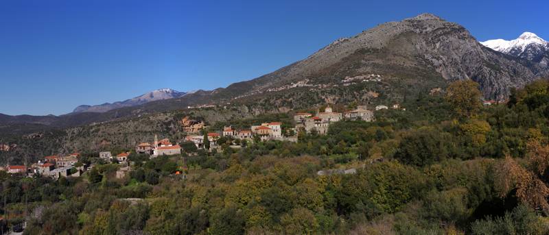
Among the other elements brought to us by the descriptions of the travelers that crossed or circumnavigated Mani during the 17th and 18th c., but also in the reports of the commanders of that period, we will meet the clear distinction between 'Choria' and 'Chores'. Choria (=villages) are all small settlements, while Chores are larger towns consisting of several closely related districts. Near Kardamyli, such 'Chores' are Tseria and Exochori, in which three to five districts articulate around the core, called 'Chora' up to today.
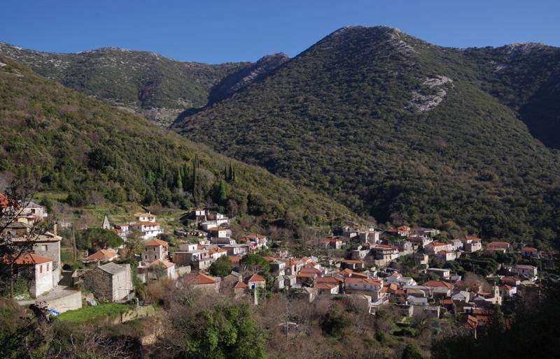
Thus, the Kardamyli district is composed of Kardamyli itself and its satellites (Petrovouni, Exochori, Prastio, Saidona and other smaller settlements), the group of villages now oriented towards Stoupa (Lefktro, Neochori, Pyrgos, the historic Kastania and some smaller villages), the villages above Agios Nikolaos (Riglia, Malsova, Pigi and Platsa) and the villages above Trachila (ie the important Lagada and the small settlements of Agios Nikon, Chotasia and Arfigia).
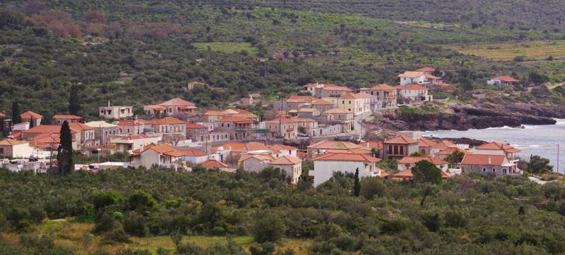
Several of the satellite settlements of Kardamyli, such as Prastio, Nikovo and Kastania, are so cohesively built that form an outer ring surrounding the core ofeach settlement. Access to the core is feasible by certain points, which despite not being actual gates - as in Mastichochoria of Chios, for example - they make the control of the entrances easy. Even today, that the villages have been divided by the central asphalt road, the core has structure similar to the fortified medieval villages of Aegean and Italy.
Kardamyli
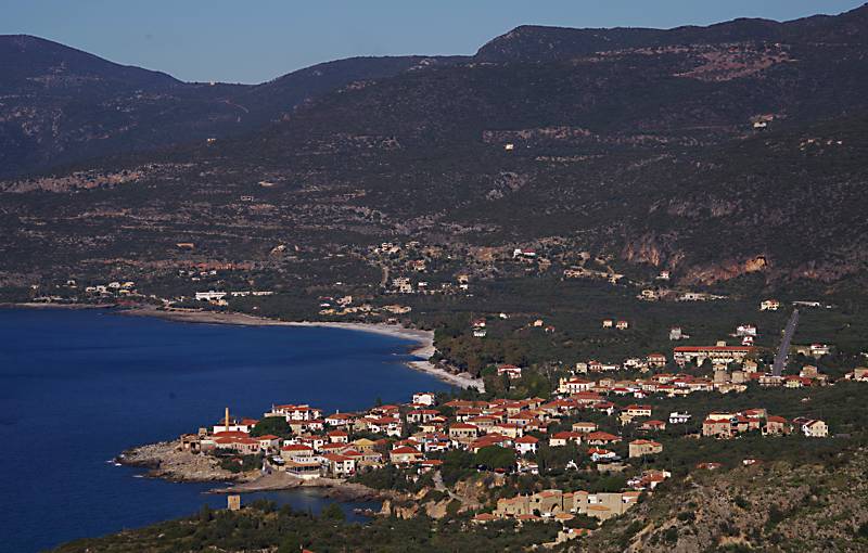
The most important settlement of the area is Kardamyli, which has always been the local social, commercial and economic center of a vast area and hosts most the social infrastructure of the district (schools, regional clinic, etc.). Accommodation and catering services are abundant and of good quality, scattered mainly in the periphery of the commercial center. The village is served by KTEL (interurban bus service) of Messenia.
Kardamyli has been inhabited since prehistoric times. The settlement is mentioned in the Homeric epic poems as part of the dowry offered by Agamemnon to Achilles, along with his daughter, as award for his participation in the Trojan War. The myth confirms that Kardamyli was the most important port of Sparti in the Messenian Gulf.
The acropolis of Kardamyli was built on the top of the steep hill that rises above the old town - building articles of the Mycenaean fortification can be seen at the base of the medieval wall of the old town.
The location and the name of the city were kept unchanged in the Byzantine period. After the concession of Mystras, several Byzantine families resorted here, among them the Troupakis family, later a distinguished faction of the area.
Today, Kardamyli is the most important settlement of Exo Mani. It consists of three districts, all of which are of architectural and historical interest. Older of all is the complex of Palea Kardamyli (Old Kardamyli), seat of the Troupakis family.
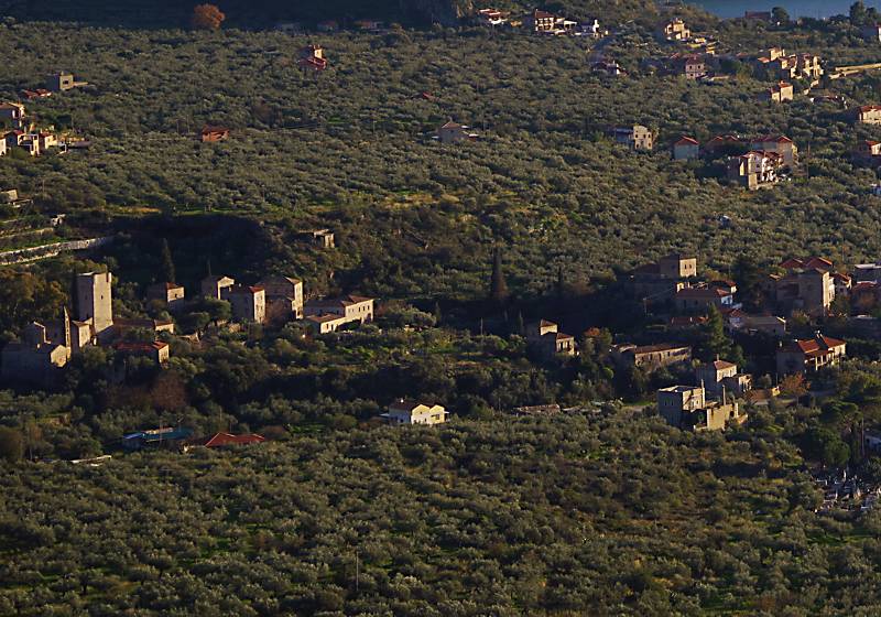
Kato Kardamyli (Lower Kardamyli) hosted the neighborhoods of the eminent families of Patriarcheas, Dimitreas, Theodoreas and Troupakis were located, had been occupying the northern side of today's settlement.
Finally, Skala, the old port of the area, has extended and replaces the nucleus of Kardamyli along the road.
South of Skala, in the small bay that used to host the old harbor, the old customs house, a large stone building with a circular tower and the church of Agios Ioannis (Aigiannakis) are preserved. In a place that supervises the old harbor, the vardia of Troupakis (watch tower) is maintained.
The villages of Kardamyli
topoguide Greece
Self-guiding in Mani peninsula
Photos and descriptions of
Kardamyli topoguide is available for Android devices as one of dozens of regions of Greece offered by the application topoguide Greece. Get the Kardamyli topoguide as an in-app purchase.
Kardamyli topoguide is also available for iOS (iPhone και iPad) devices as one of the regions offered in the hiking application Topoguide Greece. Get the in-app purchase Kardamyli topoguide and explore Mani peninsula.

