Mt Smolikas
Mt Smolikas

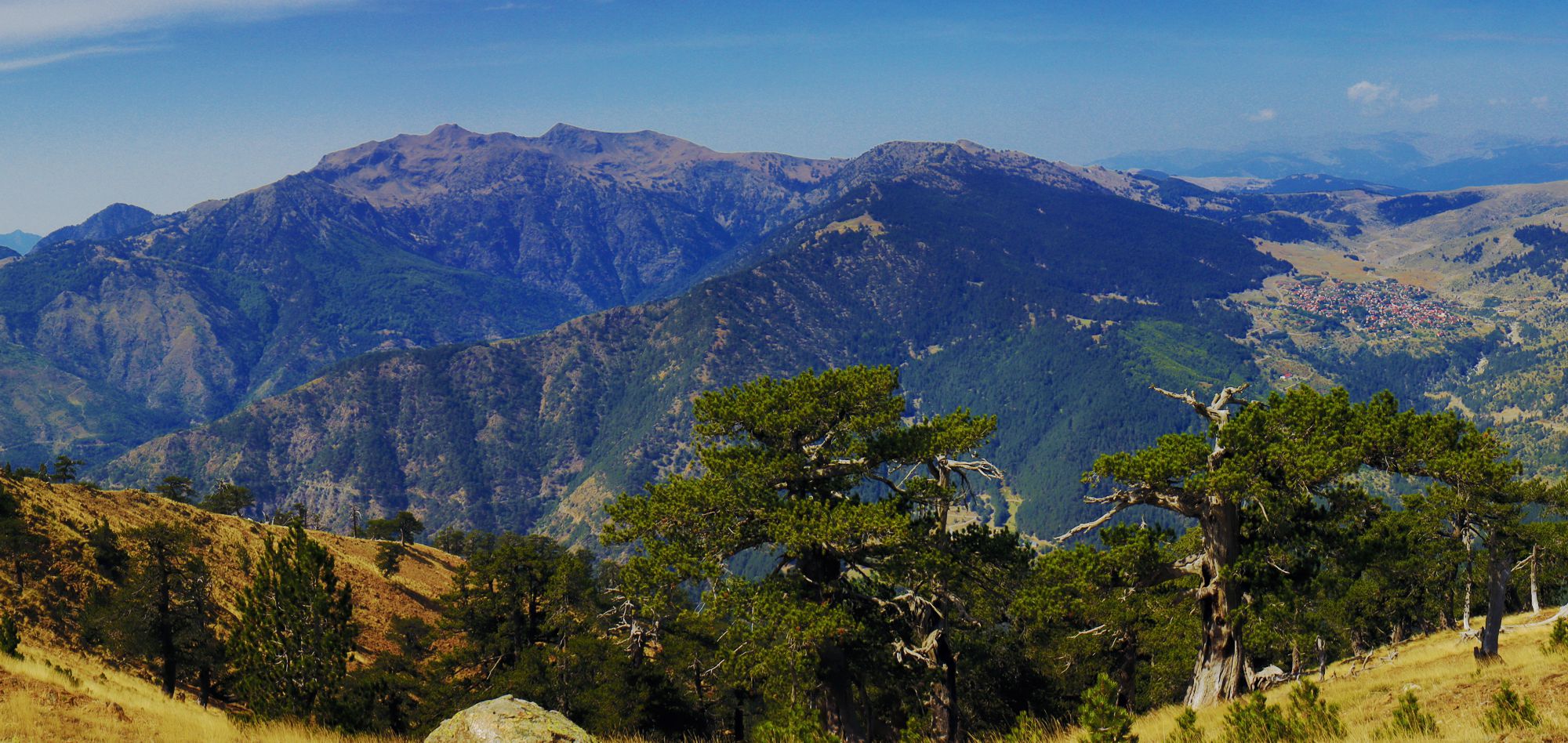
General view of the massif and the valley of Samarina (to the right)
(click to enlarge).
General view of the massif and the valley of Samarina (to the right)
Mt Smolikas (2,637m) is the second highest mountain in Greece. It stands east of the Aoos valley, facing Mt Tymfi and Zagori area. In contrast to the limestone mountains of Zagori, Mt Smolikas is formed almost entirely in ophiolites, plutonic rocks that give it its less wild form and host a specific and rare flora.

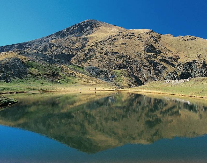
Drakolimni lake and the highest summit of Mt Smolikas
Mt Smolikas, with the massifs of Vasilitsa and Valia Kalda, is a part of the oreographic axis of Northern Pindus, connecting Central Pindos to Mt Gramos.
On the west side of the mountain nestle the villages of Elefthero, Palioseli, Pades and Armata, belonging to a cluster known as the Lakka Aoos villages. The east slopes host the large villages of Samarina, Forka and Zouzouli, while Agia Paraskevi (Kerasovo) and Drosopigi harvest the northern territories.

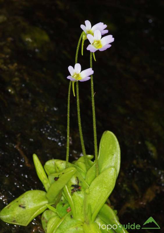
Pinguicula crystallina (subsp. hirtiflora) is a typical plant of the ophiolitic streams of Mt Smolikas
The whole mountain is an area with a great natural assets, in terms of landscape, fauna and flora and has been included in the network of protected areas Natura 2000 and the North Pindos National Park.
The middle altitude zone is covered by forests of black pine, beech and fir, while the subalpine meadows host sparse stands of Bosnian pine. The extensive alpine zone is bare, but scattered with rare and endemic plants. The fauna includes the most notable mammals of Greece (bear, wolf, chamois and roe deer) and several species of birds of prey.

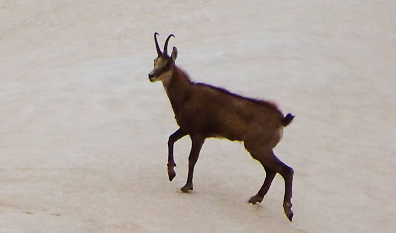
A Chamois (Rupicapra rupicapra) in its winter colours
The typical geoforms on Mt Smolikas are the glacial basin below the Mossia summit (where there is a small seasonal lake) and the permanent alpine lake at the western side of the highest peak, the infamous Dracolimni of Smolikas (Dragon Lake). Lake Drakolimni is located at an altitude of 2200 m, has an surface of about 3.000m2 and an important depth. Dozens of mountain wildflowers bloom around its perimeter in the spring, while Alpine newts swim in its waters.
Smolikas has not been spoiled by the development of the mountain road network and its old livestock paths have been preserved. The most popular trails to its summit start from Palioseli, Pades and Samarina, while two more ascents follow the large mountain valleys to the north and south of the peaks: the largely unknown Bathylakos, accessible from Agia Paraskevi, and the scary Valia Kirna ravine, the "valley of demons".
Other interesting hikes start from Pournia to Kleftis and thence to Drakolimni and the Mt Smolikas summit, or from Armata to the summit, via Petra Gagaranja.

On the mountain meadows along the trail Drosopigi-Agia Paraskevi
(click to enlarge).
On the mountain meadows along the trail Drosopigi-Agia Paraskevi
On the northern side of the mountain, a long trail from Agia Paraskevi to Drosopigi has been marked recently (this long mountain traverse has been included in the Epirus Trail plan). In contrast, the three local sections of the European Trail E6, running through the eastern slopes of Mt Smolika, have been abandoned.

topoguide greece
Mt Smolikas topoguide
Mt Smolikas topoguide will be available for Android devices as one of dozens of regions of Greece available as an in-app purchase by the application topoguide Greece.
Mt Smolikas topoguide will also be available as an in-app purchase for iOS (iPhone και iPad) devices as one of the regions offered in the hiking application Topoguide Greece.

