Nymphasia-Magouliana
Menalon Trail
Nymphasia-Magouliana

Menalon Trail
The old primary school of Nymfasia
The old primary school of Nymfasia
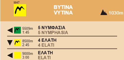
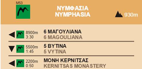
Coming out from Nymphasia the route follows a small road that that enters a pleasant oak wood, to the trailhead that heads downhill to cross the Kernitsa Bridge. From the bridge the trail ascend to the Kernitsas Monastery, a big monastic complex nested in an impressive monolith boulder.

Menalon Trail
The stone-built bridge of Kernitsa
The stone-built bridge of Kernitsa

Menalon Trail
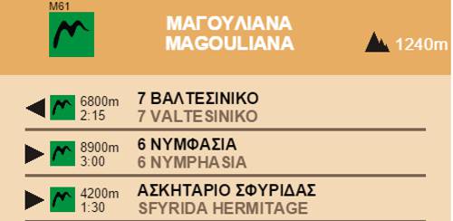
The Panagia Sfyrida hermitage
The Panagia Sfyrida hermitage

Menalon Trail
The monastery of Kernitsa
The monastery of Kernitsa

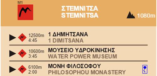
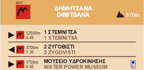
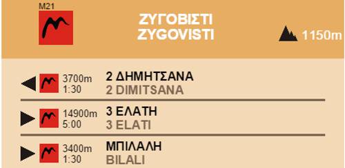
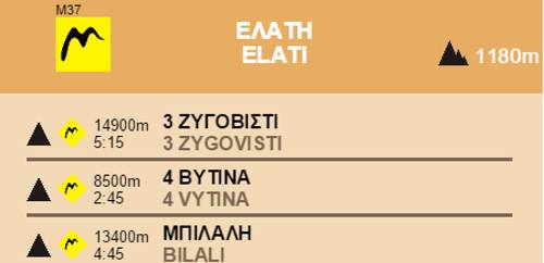
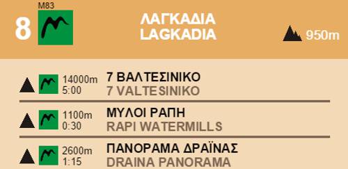
Section 6 Nymphasia-Magouliana
Elevation profile
Elevation profile
Text and photos by T. Adamakopoulos

topoguide Greece
Menalon Trail topoguide

All useful information about the section Nymphasia-Magouliana - interactive map, photos, metrics and description - is included in the digital field guide Menalon Trail topoguide.
The digital field guide Menalon Trail topoguide is available for Android devices as an in-app purchase within the application topoguide Greece. Menalon Trail is a member of the Long Trails group.
The digital field guide Menalon Trail topoguide is also available for iOS (iPhone and iPad) devices as an in-app purchase within the application Topoguide Greece. There also, Menalon Trail is a member of the Long Trails group.
Menalon Trail topoguide offers active guidance along the trail, as well as an extented guidebook on the geography, the nature and the history of the area.