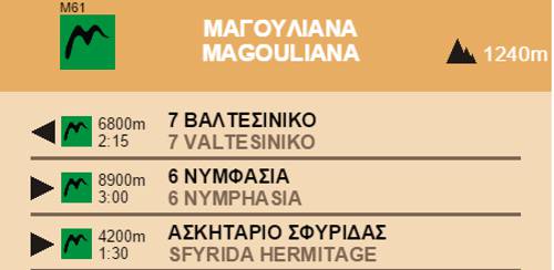
Magouliana-Valtesiniko
Menalon Trail
Magouliana-Valtesiniko

Menalon Trail
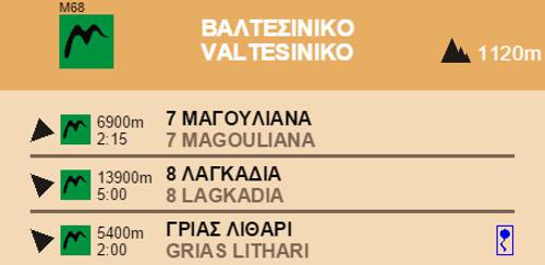
On the way up to Valtesiniko
On the way up to Valtesiniko
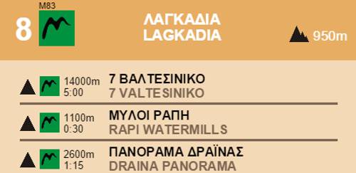
Walk across Magouliana (the village of loggers) through small roads and arrive to the saddle west of the village, where an intersection to Lasta is located and point of splendid views, surrounded by stone built threshing floors. Descend toward the old sanatorium, known as the Mana Sanatorium, through small footpaths and small roads and reach the intersection of two asphalt roads across the chapel of Agii Pantes.

Menalon Trail
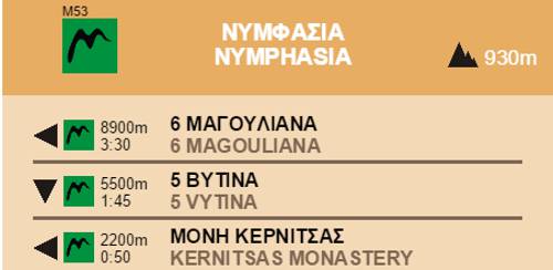
The chapel of Agii Pantes
The chapel of Agii Pantes

Menalon Trail
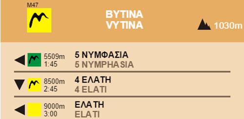
Valtesiniko
Valtesiniko

Section 7 Magouliana-Valtesiniko
Elevation profile
Elevation profile
Text and photos by T. Adamakopoulos

topoguide Greece
Menalon Trail topoguide

All useful information about the section Magouliana-Valtesiniko - interactive map, photos, metrics and description - is included in the digital field guide Menalon Trail topoguide.
The digital field guide Menalon Trail topoguide is available for Android devices as an in-app purchase within the application topoguide Greece. Menalon Trail is a member of the Long Trails group.
The digital field guide Menalon Trail topoguide is also available for iOS (iPhone and iPad) devices as an in-app purchase within the application Topoguide Greece. There also, Menalon Trail is a member of the Long Trails group.
Menalon Trail topoguide offers active guidance along the trail, as well as an extented guidebook on the geography, the nature and the history of the area.