The villages of Tenaro
The villages of Tenaro
The area from Gerolimenas to Cape Tanaro has three main inhabitation nuclei: the zone around Gerolimenas, focusing on the small harbor, the zone from Alika to the neck of Tenaro peninsula, where the reference settlement remains Vathia, although it is no longer inhabited, and finally the Tenaro Peninsula itself, a wild and poor area hosting a few, small settlements.
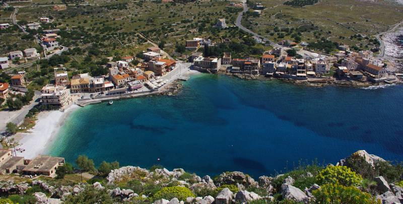
Gerolimenas

The narrow bay of Gerolimenas has two important natural features: it is protected both by the sea winds and by the "storms" of the land. Indeed, even today, access to the small port is via two easy-to-control roads, and the structure of the old core of the village reflects this concern to defence.
Gerolimenas took its name from the obvious designation "Limenas" (meaning port) and the self-explanatory suffix "Gero-", meaning "Old", that accompanies the old settlements - in contrast to the newer ones. The "old" port of Inner Mani, therefore, was the only marine gate of the region from Katopagki down to Cape Tenaro - much more leeward and spacious than Mesapos. An old pirate refuge, it became a local trading center in the late Ottoman occupation period and a real transit center of the post-revolution era. The harbor had warehouses, fishery buildings, an ice production facility and a mooring especially for sponge fishing boats, as well as shops, as it was the last stop for Greek fishermen harvesting the North African coast - and the first harbor to reach on the return route. An indication of the importance of Gerolimenas is that till the end of the 1970s, the ships serving the line Piraeus - South Peloponnese - Kythera made a stop there.
Today Gerolimenas is a picturesque harbor supporting the local fishing activity. The settlement, having experienced the tourism opportunities, has been equipped with some catering and accommodation infrastructure and in the summer lives a short glance, to return to a long hibernation of 50 residents, owners of the few shops serving the small hinterland from Katopagi to Vathia.
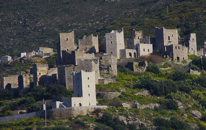
Vathia

Vathia lifts its innumerable towers over a rocky backbone, in the middle of a relatively arable valley, protected by a rocky crest. The orientation of the settlement is westward, that is, to the coast. The construction of the settlement is the result of the successive installation of four families, who were gathered here from neighboring places (Paleochora, the original inhabited place -, Goulas etc.) in the first post-Byzantine centuries.
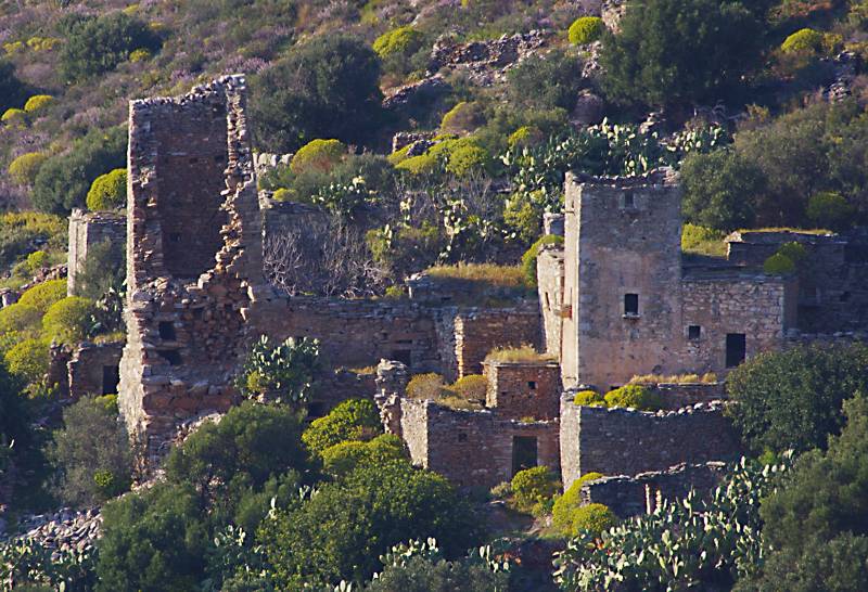
Goulas in its present form - featuring 8 ruins of houses and a war tower - is an interesting example of a fortified "xemoni" (isolated settlement) of the Ottoman period.

The first references to Vathia are from the Venetian censuses of the 16th century. The settlement gradually reached its present form after the 18th c. and flourished in the mid-19th c., the period of glory of the cultivation of olive trees. Olive grove spread out to cover every suitable land, even on the Tenaro peninsula, much of which belonged to Vathia. At its peak, the settlement had 144 buildings and hosted just over 400 residents. The four families stayed in separate neighborhoods, with about 90 houses, while there were 52 auxiliary buildings and 35 two-, three- and four-storey towers.
A characteristic of the small social affinity between the families is the complete absence of public spaces, even of a school or a Kafenion. Vathia thus materializes the structure of Mani society, which in other settlements, and in particular the larger ones, gradually adopted the common spatial patterns of Greek society.
After WWII, Vathia was gradually abandoned by its inhabitants, and finally deserted and ruined. In the 1970s it was included in the restoration program of 10 traditional settlements of the National Tourism Organization (NTO): during the years 1975-1985, NTO undertook the conversion of approximately 100 private traditional buildings into tourist accommodations, in Vathia, Mesta and Psara of Chios island, Oia of Santorini island, Vizitsa and Milies on Mt Pelion, Koryschades in Evritania, and Megalo Papigo in Zagori. In Vathia, a number of buildings, including some towers, were restored and converted to hostels, while a shop-restaurant was established in the centrer of the village. The experiment was of little success and had a short lifespan: the owners of the buildings were not committed to the further operation of the restored towers as accommodation, while the rumor of the subsidized tourism development changed the land values in the area, resulting in the appearance of short-term investment plans that diminished the traditional image of the settlement. Soon, Vathia returned to abandonment and decay.
Tenaro peninsula
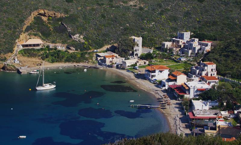
On Tenaro peninsula itself, several settlements were gradually born: Marmari, Porto Kayo, Mianes, Agriokambi, Paliros, Pyrgaki and Kokkinogia.

Marmari has borne almost all the tourist load of the area: a large hotel complex dominates its entrance. Porto Kayo, once a small fishing village that offered the best anchorage on the peninsula, is today a small coastal settlement, mainly focused on tourism and secondarily on fishing. Paliros, the only real village on the peninsula, with a tight core of beautiful towers, is now seasonally inhabited. The rest of the settlements are small gatherings of houses, deserted in winter - Agriokambi is completely deserted, in Mianes there is just a farmer, and in Kokkinogia lives a family running the unique restaurant.
topoguide Greece
Self-guiding in Mani peninsula
The cartography of
Tenaro topoguide is available for Android devices as one of dozens of regions of Greece offered by the application topoguide Greece. Get the Tenaro topoguide as an in-app purchase.
Tenaro topoguide is also available for iOS (iPhone και iPad) devices as one of the regions offered in the hiking application Topoguide Greece. Get the in-app purchase Tenaro topoguide and explore Mani peninsula.

